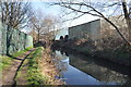
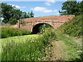
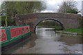
Canals
![Creative Commons Licence [Some Rights Reserved]](https://s1.geograph.org.uk/img/somerights20.gif)
Contents
North Midlands
Shared Description used on 33 images
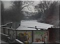
A 94 mile long canal joining the River Trent and River Mersey. Built by James Brindley and opened in 1777.
Wikipedia: Link
Wikipedia: Link
Shared Description used on 1438 images
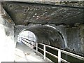
The Trent and Mersey Canal is 93·5 miles in length from Derwent Mouth to Preston Brook. The first cut was made by Josiah Wedgwood in July 1766 at Middleport (Stoke-on-Trent). The eastern section between Derwent Mouth and Shugborough (the junction with the Staffordshire and Worcestershire Canal) was already operational by 1770 and the whole canal through to Preston Brook, where it linked with the Bridgewater Canal was open for business by 1777. James Brindley was the engineer until his death in 1772. There are seventy-six locks en route to raise and lower the water level where hills impede the course. There are four tunnels, including the famous Harecastle Tunnel near Stoke-on-Trent.
Shared Description used on 41 images
The River Weaver stretches over 50 miles from its source in the Peckforton Hills to its confluence with the Manchester Ship Canal. The 20 miles downstream of Winsford were made navigable in the 1720s for the salt trade, and further improved in the 1870s. The navigation includes the Anderton Boat Lift linking with the Trent and Mersey Canal.
for further info see: Link and the Wikipedia entry Link
for further info see: Link
Shared Description used on 1407 images
The Shropshire Union Canal (from Autherley to Nantwich) was engineered by Thomas Telford and opened in 1835. There are long straight sections of this canal which required either embankments or cuttings to avoid the need for locks. Although this was a more difficult procedure, the end route was shorter and the progress for horse drawn working boats could be maintained with (hopefully) no stoppages. The canal (formerly the Birmingham and Liverpool Junction Canal) was opened at a time when railways were making serious inroads into the canal companies' businesses.
The current Shroppie north of Nantwich was formerly the Chester Canal, opened in 1779, and has wider locks and bridges. Boats up to nine feet in beam can still navigate this section; Telford's canal accommodates only narrowboats up to seven feet in beam.
The current Shroppie north of Nantwich was formerly the Chester Canal, opened in 1779, and has wider locks and bridges. Boats up to nine feet in beam can still navigate this section; Telford's canal accommodates only narrowboats up to seven feet in beam.

Shared Description used on 473 images
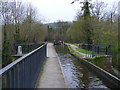
The Llangollen canal is an arm of the Shropshire Union canal that runs from Hurleston Junction to Llangollen with a wide variety of scenery along its course. Its total length is 46 miles, but the last 1½ miles from Llangollen to Llantisilio is unnavigable by any boats over about 10' length.
The canal's vital statistics for craft are:
Length 72 '
Beam 6'10"
Headroom 7'
Draught 2'3" (Hurleston to Pontcysyllte) 2' (P. to Llangollen)
These are the maximum dimensions for any craft, based on the minimum dimensions of locks & bridges.
There are a total of 21 locks on the canal, but only two between Llangollen and Whitchurch (a distance of about 31 miles). One of the most notable things about the canal is the strong flow especially in the "narrows" near Llangollen and in the tunnels near Chirk. About 12 million gallons of water passes down this canal from the River Dee to the Shropshire Union every day.
The most famous feature of this canal is the superb feat of engineering that is the 200-year-old Pontcysyllte Aqueduct rising 126' above the River Dee and running for over 335 yds - for more information on this see the numerous photos for squares SJ2742 and SJ2741
Shared Description used on 61 images
The Pontcysyllte Aqueduct is a magnificent feat of engineering, particularly considering that it is over 200 years old.It was designed and built by Thomas Telford, though William Jessop was the overall engineer in charge of the canal. It is rightly considered to be one of Telford's masterpieces and looking at the stonework of the arches today, the quality of the building work belies its age, showing no signs of wear.
It took about ten years to design and build and was opened on 26th November 1805 at an estimated cost of £47,018 equivalent to about £3m in today's money. The aqueduct has 18 arches each spanning 53' (16m) with four of its massive piers in the River Dee (Afon Dyfrdwy). The total length is 1007' (307m) and its maximum height above the river is 126' (38m) - it is just 11' (3.3m) wide at the top however !
Unsurprisingly, the structure is Grade I listed Link Link but it achieved the top accolade of becoming a World Heritage Site when it was inscribed by UNESCO on the World Heritage List on 27 June 2009 Link
Finally, from a Geograph perspective it is noteworthy that it crosses a gridline and so photographs of it appear in both squares SJ2741 and SJ2742
It took about ten years to design and build and was opened on 26th November 1805 at an estimated cost of £47,018 equivalent to about £3m in today's money. The aqueduct has 18 arches each spanning 53' (16m) with four of its massive piers in the River Dee (Afon Dyfrdwy). The total length is 1007' (307m) and its maximum height above the river is 126' (38m) - it is just 11' (3.3m) wide at the top however !
Unsurprisingly, the structure is Grade I listed Link
Finally, from a Geograph perspective it is noteworthy that it crosses a gridline and so photographs of it appear in both squares SJ2741 and SJ2742
Shared Description used on 83 images
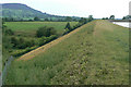
One of the last narrow canals to be built the canal was approved by Act of Parliament in April 1826. Thomas Telford surveyed the canal and construction was engineered by William Crosley. The completed canal was opened on 9th November 1831 at a cost of £320,000.00. The canal was bought out by the Manchester, Sheffield & Lincoln Railway in 1847. With nationalisation in 1947 it passed to the Docks & Inland Waterways Board with commercial carrying finishing only in the 1960's shortly before British Waterways was formed. The canal runs from Marple Junction with the Peak Forest Canal in the north 26¼ miles to the stop lock at Hall Green near Kidsgrove. The canal is noted for its six fine change or snake bridges where the tow-path changes sides of the canal. These bridges were designed to allow the horse to move over without having to untie it from the boat. Thanks to Telford's design for commercial traffic the Macclesfield Canal has a very shallow and tapered bottom. The deep channel is just wide enough for two boats to pass in the centre making mooring other than at wharves 'challenging'.
Shared Description used on 539 images
The Peak Forest Canal runs for 15 miles between Ashton under Lyne and Whaley Bridge.
It was built to link the Ashton Canal with the tramways that brought limestone from the Peak District quarries.
The Lower Peak Forest Canal forms part of the "Cheshire Ring".
Link Pennine Waterways website including a "virtual tour" of the canal
Link and Link for information on the history of the canal
It was built to link the Ashton Canal with the tramways that brought limestone from the Peak District quarries.
The Lower Peak Forest Canal forms part of the "Cheshire Ring".
Link
Link
Shared Description used on 30 images
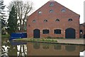
Bugsworth Basin is situated at the head of navigation of the Peak Forest Canal, in the village of Buxworth. The Basin was once the largest inland port on the narrow canal system; a busy interchange between tramway and canal where boats were loaded with limestone.
Bugsworth Basin closed in 1927 and by the 1960s was dry and overgrown. In 1968 volunteers from the Inland Waterways Protection Society began restoration and Bugsworth Basin was finally re-opened to navigation in March 2005.
Today it is unique as the only surviving canal and tramway interchange in the UK. It is recognised as an internationally important industrial heritage site, designated as a scheduled ancient monument and is protected under the Ancient Monuments and Archaeological Areas Act, 1979.
Shared Description used on 316 images
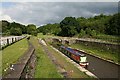
The Chesterfield Canal is a 46-mile-long navigable channel from the Derbyshire town of Chesterfield to the River Trent, passing through Staveley, Shireoaks, Worksop and Retford. The sections between West Stockwith junction on the Trent and Kiveton Park near Rotherham and from Staveley to just short of Chesterfield are navigable. The 10 miles from Norwood tunnel to Staveley are disused, Norwood tunnel has partly collapsed. The Chesterfield Canal trust plan to restore this section, but it requires a major diversion around Killamarsh.
The route is a typical James Brindley contour canal. An application was made to Parliament and the Act of Parliament received the Royal Assent on 28 March 1771. The canal was a success when it opened in 1777, however the Manchester, Sheffield and Lincolnshire Railway opened a parallel line in 1849. The last commercial traffic was in 1908.
The route is a typical James Brindley contour canal. An application was made to Parliament and the Act of Parliament received the Royal Assent on 28 March 1771. The canal was a success when it opened in 1777, however the Manchester, Sheffield and Lincolnshire Railway opened a parallel line in 1849. The last commercial traffic was in 1908.
Shared Description used on 595 images
The Grantham Canal was built from the River Trent in Nottingham to Grantham, some 33 miles between 1793 and 1797 at a cost of £118,500 and narrow boats and barges transported coal, building materials and groceries through 18 locks to Grantham. On the return journey they transported corn, malt, beans, wool and other agricultural produce. Due to the development and the success of the railways the canal was closed in 1935 and left to its fate. Over the years it fell into disrepair with many of the "fixtures and fittings" being demolished.
The Grantham Canal Restoration Society is an active body which has been working towards the reopening of the canal as a recreational and commercial waterway. Whether this will ever happen is up for debate with many obstacles in the way.
See Link for further information.
The Grantham Canal Restoration Society is an active body which has been working towards the reopening of the canal as a recreational and commercial waterway. Whether this will ever happen is up for debate with many obstacles in the way.
See Link
Shared Description used on 306 images
The Ashby Canal was originally built to provide transport for the limeworks and coal mines around Ashby de la Zouch but it only became profitable when a new colliery at Moira was opened in 1804. The canal was purchased by the Midland Railway in 1845 but coal traffic continued to thrive until the end of the 19th century; after that the northern end of the canal began to suffer serious damage from mining subsidence and eight miles of waterway eventually had to be abandoned. Nevertheless, the last commercial load was carried as late as 1970. Nowadays, the canal is an important leisure waterway offering 22 lock-free miles from its southern end at Marston Junction to the terminus just north of Snarestone.
( Page < < prev 1 2 3 4 5 6 7 8 next >> )