Page 6
Kennet Avon Canal Newbury to Devizes
![Creative Commons Licence [Some Rights Reserved]](https://s1.geograph.org.uk/img/somerights20.gif)
Great Britain 1:50 000 Scale Colour Raster Mapping Extracts © Crown copyright Ordnance Survey. All Rights Reserved. Educational licence 100045616.
Contents
- NEWBURY
- Newbury Bridge No.32: Newbury Lock No.85: John Gould Memorial: West Mills Swing Bridge No.33:
- West Mills: West Mills Swing Bridge No.33: Northcroft Bridge No.34:
- Guyers Lock No.84: Enborne Bridge No.35:
- Guyers Lock No.84: Enborne Bridge No.35:
- Newbury Bypass: Higg's Lock No.83:
- Pickletimber Railway Bridge:
- Benham Bridge No.37: Benham Lock No.82:
- Hamstead Bridge No.38: Hamstead Lock No.81:
- Copse Lock No.80: Dreweat's Bridge No.39: Dreweat's Lock No.79:
- Dreweat's Lock No.79: Irish Hill:
- Shepherd's Bridge No.40:
- Kintbury Bridge No.41: Kintbury Lock No.78: Vicarage Bridge No.42:
- Orchard Meadow Bridge No.43: Brunsden Lock Bridge No.44: Brunsden Lock No.77:
- Railway Bridge No.45:
- Wire Lock Bridge No.45: Wire Lock No.76:
- Dunmill Lock Bridge No.46: Dunmill Lock No.75:
- Station Road Bridge No.48:
- Hungerford Town Bridge No.49: Hungerford Wharf: Hungerford Lock No.74: Hungerford Church Swing Bridge No.50:
- Hungerford Marsh Swing Bridge No.51: Hungerford Marsh Lock 72: Cobbler's Lock Footbridge No.52: Cobbler's Lock No.72:
- Barrackfield Swing Bridge: Railway Bridge No.54: Picketfield Lock No.71:
- Froxfield Bridge No.55: Froxfield Bottom Lock No.70: Froxfield Middle Lock No.69:
- Oakhill Down Bridge No.56: Oakhill Down Lock No.68:
- Fore Bridge No.57: Little Bedwin Footbridge: Little Bedwin Lock No.67:
- Little Bedwin Lock No.67: Little Bedwin Bridge No.58:
- Potter's Lock No.66:
- Burnt Mill Footbridge No.59: Burnt Mill Lock No.65: Bedwyn Wharf Bridge No.60:
- Bedwyn Church Bridge No.61: Bedwyn Church Lock No.64:
- Mill Bridge No.62: Beech Tree Walk Bridge No.98: Beech Grove Lock No.63: New Bridge No.99:
- Crofton Lock No.62: Crofton Crossing Bridge No.100: Crofton Lock No.61: Crofton Lock No.60: Wilton Water: Crofton Pumping Station: Crofton Lock No.59:
- Freewarren Bridge No.101: Sam Farmer Lock No.58: Crofton Lock No.57: Crofton Lock No.56:
- Wolfhall Fields Bridge No.102: Crofton Top Lock No.55: Wolfhall Bridge No.103:
- Bruce Tunnel:
- Burbage Wharf Bridge No.104: Burbage Wharf:
- Wootton Top - Cadley Lock No.54: Cadley Bridge No.105: Brimslade Lock No.53: Brimslade Bridge No.106:
- Brimslade Bridge No.106: Brimslade Lock No.53: Heathey Close Lock No.52: Heathey Close Bridge No.107:
- Wootton Rivers Bottom Lock No.51: Wootton Rivers Bridge No.108: Wootton Rivers Farm Bridge No.109: Carrel Crown Bridge No.110:
- New Mill Bridge No.111:
- Milkhouse Water Bridge No.112:
- Pains Bridge No.113:
- Pewsey Wharf: Pewsey Bridge No.114: Bristow Bridge No.115:
- Stowell Park Footbridge No.116: Wilcot Bridge No.117:
- Wilcot Swing Bridge No.118: Bowdens Bridge No.119:
- Wilcot Wide Water:
- Lady's or Ladies Bridge No.120:
- Woodborough Fields Bridge No.121:
- Alton Valley Bridge No.123: Honey Street Bridge No.124:
- Stanton Bridge No.125:
- England's Bridge No.126:
- All Cannings Bridge No.127: Woodway Bridge No.128:
- Allington Swing Bridge No.129:
- Allington Bridge No.130: Norton Fields Swing Bridge No.131:
- Horton Chain Bridge No.132
- Bishops Cannings Swing Bridge No.133
- Horton Bridge No.134
- Laywood Bridge No.135
- Devizes Marina
- Coate Bridge No.136: Brickham Bridge No.137:
- London Road Bridge No.138
- Park Bridge No.139: Cemetery Road Bridge No.140: Devizes Wharf:
- DEVIZES
 Map © Crown Copyright") | SU3468 |
Station Road Bridge No.48:
| SU3468 | 2009 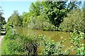 |
2013 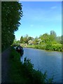 | |
2009  | |
2010 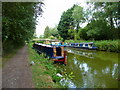 | |
2008 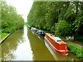 | |
2008 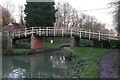 | |
2009 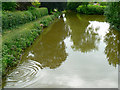 | |
2014 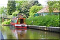 | |
2008
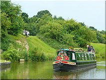
A passing narrowboat and dog-walkers on the towpath.
by Jonathan Billinger
2008
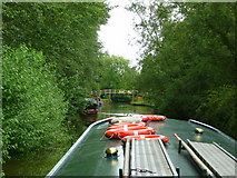
Approaching Hungerford from the east - helmsman's view.
by Jonathan Billinger
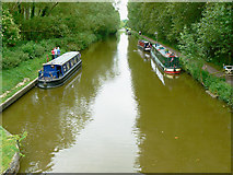
2008
Part of the towpath alongside the Kennet And Avon Canal.
by Chris Talbot
2009
The viewpoint is a footbridge over the canal that eventually terminates in the High Street behind the viewpoint.
by anonymous1000
1976
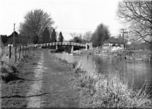
The towpath is on the south side here, having changed sides at Dunmill Bridge, so this again is a westward-facing photograph, with Hungerford Station just out of picture to the left. The attractive small building on the right is a sewage pumping station.
by Dr Neil Clifton
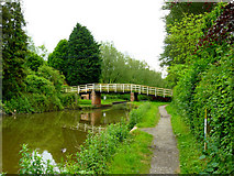
2009
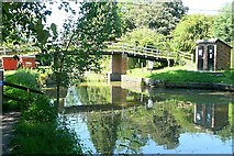
A pedestrian bridge over the Kennet and Avon Canal. It is popularly know as sanitary station bridge because the brick building to right is a boat facilities point, for filling with drinking water, emptying toilets and disposing of rubbish. They can be found on all canals, at convenient places at about 10 mile intervals.
by Graham Horn
2010
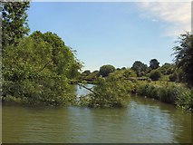
The fallen tree appeared to block the route but deft manoeuvres by the crew managed to get it out of the way, on the return a man had turned up with a chain saw to cut the tree away.
2009
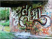
Taggers get everywhere these days.
by anonymous1000
Great Britain 1:50 000 Scale Colour Raster Mapping Extracts © Crown copyright Ordnance Survey. All Rights Reserved. Educational licence 100045616.
( Page < < prev 1 2 3 4 5 6 7 8 9 10 11 12 13 ... next >> )