Bolsa via Bunnahabhain and Beinn Thrasda, Islay
This was another of the many walks I've walked through on the map many times, and which I've done parts of several times. I'd been checking the forecast all week and the day I chose to do it in reality dawned bright with cumulus clouds dotted promisingly across the sky.
I started from Bunnahbhain, walking down to the deer gate 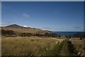 and then to the Margadale River, which is one of my favourite views on Islay.
 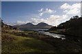 The walk up to Rubh' a' Mhail lighthouse is one I have done several times; it is always boggy and I was expecting horrendous conditions after all the rainfall of recent months. Either it wasn't that bad or I'm just getting used to walking very slowly, testing each footstep with my stick before commiting to it! It's blanket bog all the way up to the lighthouse and for a time the sun went in
 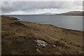 and it started hailstoning. Worryingly, I looked to the northwest, from where the grey clouds scuttled across the sky. Hmmmmm. I hoped the forecast was going to turn out right and it would clear later in the day.
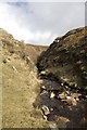
The quad bike track to the lighthouse is pretty clear most of the way, but if all else fails, you can follow the telegraph poles. 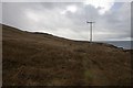 There are several fords across the path - the Uisge Fear Fian
 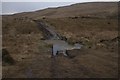 and Geal Uisge (White Water)
 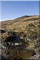 being the two I encountered before turning up by the waterfall on the Geal Uisge
 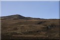 .
.
I wanted to climb Beinn Thrasda (Gaelic for either 'Horizontal' or 'Diagonal' Mountain) as I'd not done so before and it meant tackling a 'green' square. This meant following deer tracks at best, and making your own tracks at worst 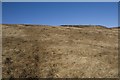 . Beinn Thrasda is situated north-east of Sgarbh Breac (Speckled Cormorant)
 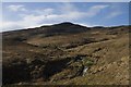 . I followed Geal Uisge more or less to its source
 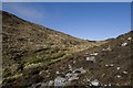 and then headed directly up Beinn Thrasda.
 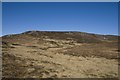 .
.
By the time I reached the summit, the sun was blazing down, creating a whole spectrum of glorious hues and casting diamonds on the ocean. There was barely a breath of wind at the summit either and I took photos in all directions 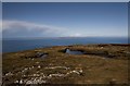 ,
, 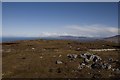 and
and 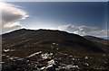 before gradually and carefully descending the steep slopes on the west of the mountain. I'm not good at heights and, to make it worse, it was very slippery underfoot and I nearly fell a few times.
 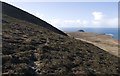 Scary or not, I couldn't help stopping to take photos of the glorious vista before me. I had not seen Bagh an Da Dhoruis from this angle before
 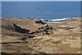 and the sandy beach beckoned me and had to be resisted - another day maybe!
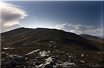
I was looking constantly for the ruin of Bolsa (Old Norse for 'farm'). I had not been able to see it even from the summit using binoculars. Where was it? Why couldn't I see it? 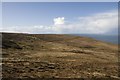 Behind me I could see the scree adorned slopes of Beinn Thrasda
 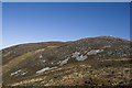 and then gradually the lower slopes of Sgarbh Breac were behind me too
 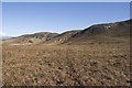 , but still no Bolsa ahead of me. I reached an old boundary line, marked by iron posts
 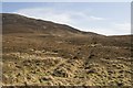 and there was still no sign of my destination.
Not until I was virtually upon it, did I catch my first glimpse of this old farm 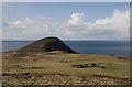 and
and 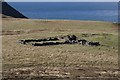 . At last! I was so excited. It was 13:50 when I reached the ruin and sat down with my lunch, watched only by the occasional Red Deer. In 1542 this land was apparently granted to Hector MacLean on the basis that it had once belonged to his grandfather. Since 1878 it has been a ruin. It was like a summer's day
 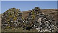 here right at the north of Islay and I relished the tranquility and solitude for a while before checking the map and heading back south-east.
I was heading for Gleann nam Meirleach (Valley of the Robbers) through which the Allt Mor flows 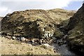 ,
,  and
and 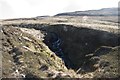 . This was new territory for me and I was delighted to see my first spring migrant, a Red Admiral butterfly. 'From whence camest thou, oh tiny creature? I wish you well.' It flew along the shallow banks of the burn
 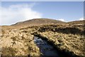 and disappeared before I had time to photograph it.
Before long I was at Dubh Loch (Black Loch) 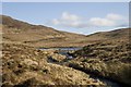 and I negotiated my way across deep bog round the loch's northern side
 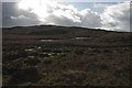 and then entered the glen proper
 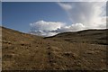 and
and 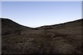 . Glen of the Robber. I wonder how it got its name. I hope I find someone who can tell me. Before long I could see both west
 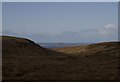 and east
 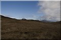 from the same viewpoint.
Wanting to return to Loch Mhurchaidh, I took a brief detour for a final stop 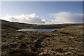 before the last leg of my walk. I'd intended to follow the Allt Bhachlaigh to the coast and then head south back to the car, but ahead of me a decent quad bike track ascended Shun Bheinn, marking a way I'd never trod before.
 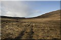 I followed the track, which led perilously close to the summit of the hill
 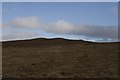 , but with weary legs, it was not hard to resist the temptation for another (uphill) detour. I trudged on, startling a small herd of Red Deer within a few feet of me.
Soon I was back in familiar territory, looking back to Shun Bheinn 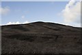 and forward to the gate in the deer fence near the reservoir
 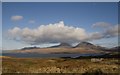 . The path is more solid now and I crossed the bridge over the Abhainn Araig
 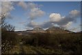 and walked wearily back to where I'd started 6 and a half hours before
 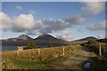 . A walk worth repeating!
- When
- Wed, 7 Mar 2012 at 14:14
- Grid Square
 NR3877
- Chosen Photo
blog comments powered by Disqus