Geo-Trips :: Climbing Creag Uchdag from the road at Ardeonaig
The Corbett of Creag Uchdag
A walk from Ardeonaig, Sun, 30 Sep 2012 by Richard Law
This, by comparison to some of the long days that I've documented here, is a relatively easy walk. 'Only' about 8 miles long, and with less than 2500' of climbing in it.
Park considerately at the end of the lane opposite the hotel at Ardeonaig, and the walk starts from there by visiting the ancient church ruins and graveyard of Cill mo Chormaig, then follows the delightful Fin Glen for a couple of miles up into the hills, before heading up onto the Corbett of Creag Uchdag. That makes a great viewpoint for much of this area, from Loch Tay and the Ben Lawers range in the north, the Cairngorms to the northeast, Loch Lednock to the south and as far as Ben Nevis to the west.
A short descent and a slightly boggy section through the peat brings you to Meall nan Oighreag, with its disused lead mine, which is probably 18th century. From there, it's all downhill, albeit a little boggy in places, to the road at Ardeonaig again. It would be possible to descend a little further east, following the county boundary down towards Wester Tullich, but that would leave you with a mile of road-walking at the end of the day.
On the map below, the grey line is the GPS track from this trip. Click the blue circles to see a photograph taken from that spot and read further information about the location. The blue lines indicate the direction of view. There is also a slideshow of this trip. ( )
↓ Scroll down here ↓
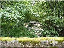
The Ardeonaig Burn
Not a day for trying to ford the burn - heavy rain last night, and it was running... more
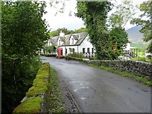
The Ardeonaig Hotel
A lively little business on the quiet south road along Loch Tay.
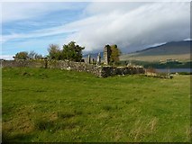
The ruins of Cill mo Chormaig
Within the boundary of a burial ground that remains in use to the current day,... more
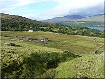
Sheep farm buildings above Ardeonaig
The old right of way below the Fin Glen
Presumably a drovers' route back in the day, this is now used by the farm quad... more
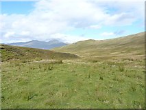
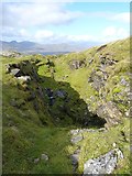
Down into the Fin Glen
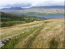
From the drovers' route on the hillside, this looks down the glen and across Loch... more
A bend in the Finglen Burn
More or less the opposite view to that in [[865282]], here we are looking down the... more
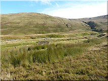
Shieling in the Fin Glen
One of a number of collapsed shielings in the bottom of the glen.
Site of shielings in the Fin Glen
Very little to see here apart from a few scattered stones; the sad remains of an... more
Shieling remains
The low walls of sheep and cattle fanks, and a few scattered shielings, in the Fin... more
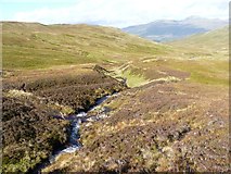
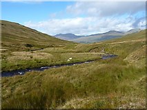
The Finglen Burn
The old right of way through the glen crosses the burn at a ford just here.
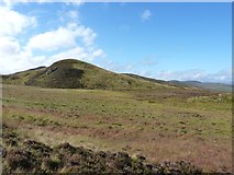
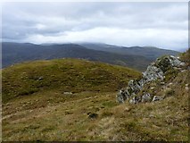
On the north side of Tom a' Mhoraire
Tom a' Mhoraire itself is a rather lowly outlier of the Corbett Creag Uchdag, but... more
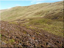
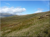
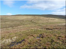
Heather and boggy ground on the west side of Creag Uchdag
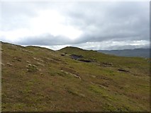
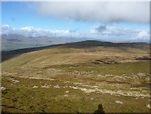
The heathery 'lump' of Tom a' Mhoraire
Across the flattish ground between Creag Uchdag and the outlying hillock of Tom a'... more
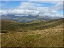
Down the Fin Glen from Creag Uchdag
Looking downhill on the western side of the Corbett, with the Fin Glen filling the... more
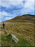
Climbing Creag Uchdag
A few minutes 'breather' on the western approach to the Corbett; the going... more
Straight down the Fin Glen
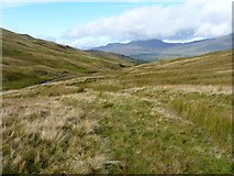
From this perspective, the Fin Glen is something of a hanging valley, being... more
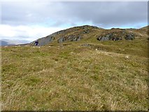
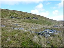
Craggy outcrops on the western side of Creag Uchdag
A grassy outlier on Creag Uchdag
A small grassy hillock on the western flank of the Corbett; other hills in the... more
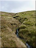
Upper waters of the Eas Domhain
A tributary of the Finglen Burn, this rises high on Creag Uchdag.
Creag Uchdag - just south of the summit ridge
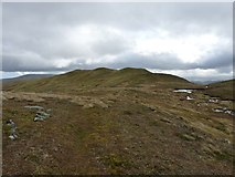
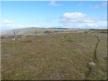
Along the summit ridge of Creag Uchdag
It's not really a 'ridge', more a long grassy field with a series of disused... more
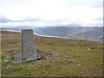
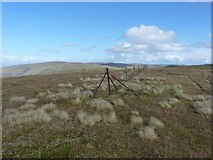
Creag Uchdag - summit trig
At the summit of the hill, the trig pillar bears flushbracket number S6473, and... more
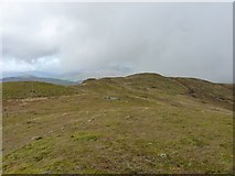
NW along the summit ridge of Creag Uchdag
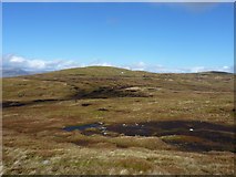
North across Meall Ramhar to Meall nan Oighreag
An area of slightly eroded peat lies at the bealach between Creag Uchdag and Meall... more
On the boggy bealach heading for Meall nan Oighreag
The grassy northern slopes of Creag Uchdag (behind us) give way to this rather... more
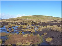
In the peat hags
Despite appearances, the 'bog' was actually no more than a couple of inches deep... more
Abandoned mine buildings on the south side of Meall nan Oighreag
A small lead mine of rather uncertain age was worked just uphill from this point;... more
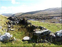
Lead mine buildings
The ruins of a 2- or 3-room building on the south side of Meall nan Oighreag,... more
Fenceposts at the summit of Meall nan Oighreag
The highest point of the hill is just about here - at the bend in the fence.
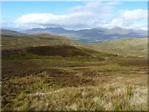
Eastwards view from the summit of Meall nan Oighreag
Roughly eastwards from the summit across the wild uplands between Loch Tay and... more
Lead mine/pit high on Meall nan Oighreag
The remains of the lead mine just below the summit; in shadow on the left, Trevor... more
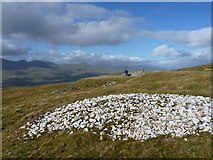
Mining spoil from the old lead mine
Several heaps of broken rocks lie around the old mine workings; this one consists... more
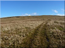
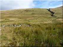
ATV track on Meall nan Oighreag
The track goes uphill, more or less directly to the old lead mine near the summit... more
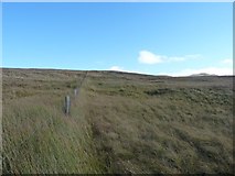
Fence on the hillside of Meall nan Oighreag
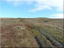
ATV track heading up Meall nan Oighreag
This track wends its way up the hill, through or around a number of boggy sections.
Looking back up Meall nan Oighreag
The ATV track that climbs the hill is obvious in this shot.
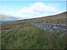
A well built wall above Ardeonaig
Fences higher up the hills have fallen into disrepair, but this wall seems to be... more
All images © Richard Law and available under a
Creative Commons licence  .
.