Geo-Trips :: A walk around the Halberton area of Devon
Halberton area
A walk from Cullompton, Mon, 6 Dec 2010 by Derek Harper
A very misty - even foggy - day, with sun only breaking through very briefly. Dropped by car at Cullompton services, and followed a circuit via Brithem Bottom (persistent bullocks, and shock from electric fence at Pond Farm), Sock Hill and Ash Thomas to the Grand Western Canal (where the sun appeared), then via the edge of Tiverton to take a couple of squares east of Craze Lowman, back via Halberton (post office closed) and down Willand Road to catch a 1B bus from Willand post office (open but very busy). 16 miles, about 6 hours.
Click the blue circles to see a photograph taken from that spot and read further information about the location. The blue lines indicate the direction of view. There is also a slideshow of this trip. ( )
↓ Scroll down here ↓
Pay station, Cullompton services
In the northern end of the car parks at the M5 services, on a somewhat foggy morning.
Trees by the Mill Race
Thick frost on the roadside fence beside Millennium Way, and the patch of meadow... more
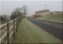
Millennium Way, Cullompton
The road skirts new housing north of the town; this stepped terrace of houses is... more
Mill Race, Cullompton
The mill race leat is in the foreground, approaching (between frosty meadows) the... more
Spratford Stream, Cullompton
The stream is on the left; the mill race (see [[2191678]]) is on the right and... more

B3181 at Five Bridges
The B road swings across Spratford Stream (the bridge is being crossed by the... more
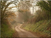
Lane to Brithem Bottom
The lane climbs a little from the Spratford Stream valley as it passes Kingsley... more
Moorstone Barton
The farm is medieval in origin... more
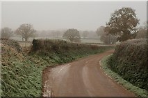
Lane to Brithem Bottom
Having climbed a little to Moorhouse Barton, the winding lane from Five Bridges... more
Stream by the lane, Brithem Bottom
Taken further east than [[1060002]] and looking in the other direction, with the... more
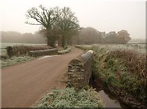
Bridge near Brithem Bottom
The parapets (the nearer visible in [[1060002]]) of the bridge over a tributary of... more
Brithem Bottom
The hamlet seen on a frosty, misty day from the lane climbing in from the east,... more
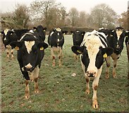
Bullocks, Brithem Bottom
Rather inexpertly playing a game of grandmother's footsteps as they follow me at... more
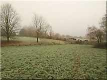
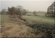
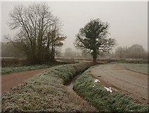
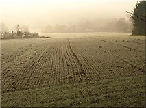
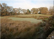
Meadow, Brithem Bottom
A frosty meadow beside the stream shown in [[2191996]], and crossed by Halberton... more
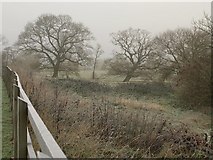
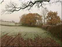
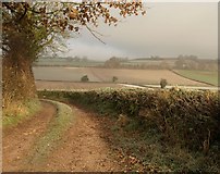
Trees along the hedge
Oaks along a field boundary beside Halberton Footpath 4 as it approaches Pond... more
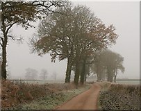
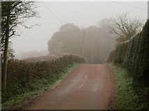
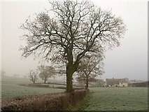
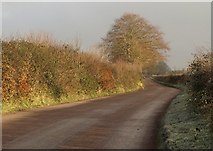
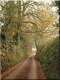
Trees by the lane near Pond Cottage
With further distant trees in the mist and frost. An almost straight stretch on a... more
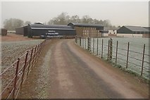
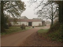
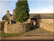
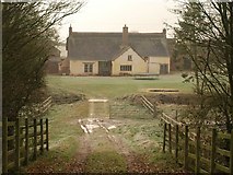
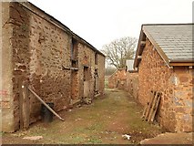
Leonard Farm
An old Devon farm; the farmhouse, just visible on the right between the barns, is... more
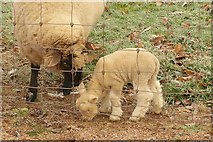
Lamb (& mum), Leonard Farm
Through a fence, but hard to resist this rather small lamb beside Halberton... more
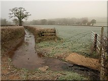
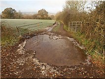
Ford on Halberton Footpath 10
It was with some relief that I realised that Halberton Footpath 10 leaves the... more
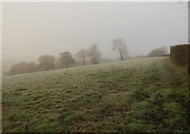
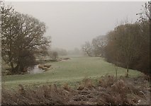
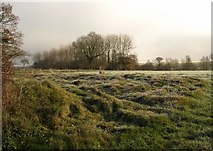
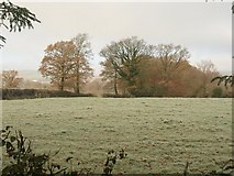
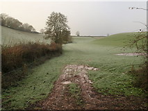
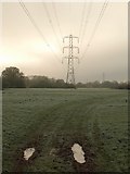
Mist and frost, Sock Hill
A view across a frosty field from Halberton Footpath 10 just south of its crossing... more
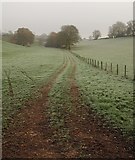
Field on Sock Hill
Halberton Footpath 10 turns right over a stile through the hedge just before the... more
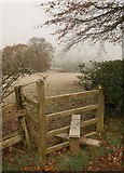
Stile near Ash Thomas
Carrying Halberton Footpath 10 towards the hamlet on a frosty, misty day.
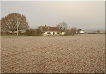
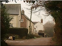
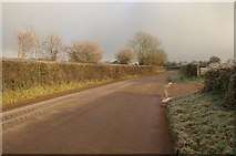
Houses near Ash Thomas
Houses on a lane near Curham, seen from Halberton Footpath 10 as it crosses a... more
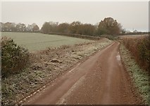
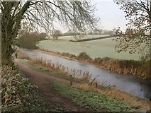
Lane to Rowridge
And, more immediately, to the Grand Western Canal, which it runs beside for nearly... more
Aqueduct, Grand Western Canal
The canal crosses the cutting of the dismantled Tiverton branch of the Bristol and... more
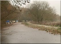
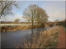
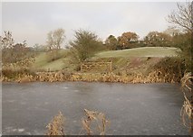
Grand Western Canal frozen
Narrowboats locked into the frozen canal southwest of the aqueduct over the... more
Herne Place
[[1887167]] seen at a different season from the road southwest of Halberton. The... more
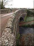
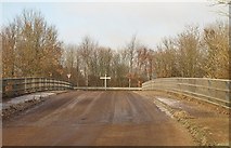
Crownhill Bridge
The bridge... more
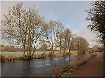
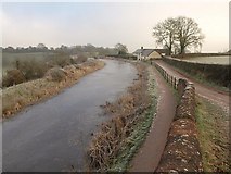
Grand Western Canal
Trees along the west side of the frozen canal, with the old A373 bridge on the right.
Grand Western Canal
A similar view to [[2192967]], taken much nearer the road bridge... more
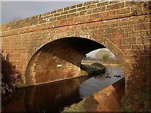
Tiverton Road Bridge, Grand Western Canal
The bridge... more
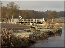
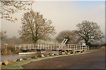
Dudley Weatherley Jubilee Bridge
This new lift bridge, built in 2002, links the car park beside Tiverton Road... more
Tiverton Road Bridge, Grand Western Canal
Looking in the other direction to [[2192975]], and back down the stretch of canal... more
Track by the Grand Western Canal
Just north of the Tiverton Road Bridge, this field access track runs parallel to... more
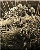
Frosty hogweed
A dead flower-head of hogweed, frosted on a bank beside the old A373 just east of... more
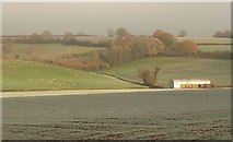
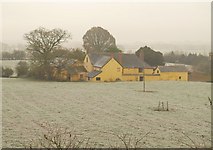
Barn near Halberton
A view on a frosty day from the old main road just east of Tiverton Road Bridge.... more
Dudley Weatherley Jubilee Bridge
A view of [[2192993]] from the entrance to the car park beside Tiverton Road Bridge.
Young crop, Hartnoll Farm
Hartnoll Farm is the location for the Mid-Devon show. This field of a winter... more
Tred carefully
For you tred on my dreams of universally correct spelling. Okay, that was... more
Field near Putson Cross
From a gateway on the lane between Post Hill and Putson Cross. The field drops... more
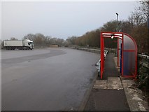
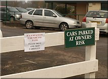
Field boundary, Putson Cross
The lorries are parked in a layby on the A361 link road. Until it was built in... more
Bridge across the A361
Uplowman Road crosses over the dual carriageway link road and arrives at a... more
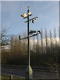
Weather station, A361
At least, I assume it is surveying weather conditions. This is between Uplowman... more
Road to Uplowman
The shadow of [[2193968]] falls across the foreground. At this bend, the road to... more
Tributary of the Lowman
A small stream runs through a rushy, frosty field to join the River Lowman, which... more
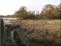
Rushy field near the Lowman
Looking to the right from the same spot as [[2193996]], with the same field... more
Bradford Farm
The entrance to a large quadragular farmyard off the road between Craze Lowman and... more
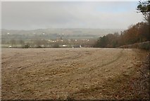
Field by Bradford Farm
A frosty field on the other side of the road from [[2194024]], with the trees of... more
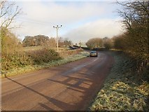
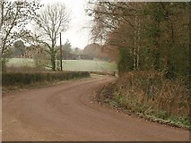
Road to Uplowman
A broad lane running along the ridge south of the Lowman valley, here enjoying a... more
Icy puddle above the Lowman valley
The track leads away from Uplowman Road, dropping into the river valley.
Uplowman Road
The road passes a track leading to Sellake across the A361. Frost on verge and... more
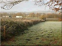
Frosty field near Widhayes Farm
Looking through a line of trees beside Uplowman Road. On the far side, a tiny... more
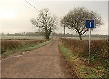
Sellake farm
Viewed from Halberton Footpath 71 just south of its crossing of the A361. The... more
Farm buildings, Sellake
Halberton Footpath 71 leaves the no through lane between these stone outbuildings.
Greenway
The lane from Uplowman Road, here sunken and dropping to cross a short steep... more
Valley near Halberton
Looking up a small but steep side valley from the lane shown in [[2194791]], with... more
Track down valley near Halberton
Looking down the valley from the other side of the lane to [[2194834]]. Just after... more
Greenway
The lane from Uplowman Road to Halberton drops towards Greenway Bridge across the... more
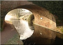
Grand Western Canal
The frozen canal near Halberton, seen from the path leading to the bridge shown in... more
Grand Western Canal
A view from the bridge shown in [[1176468]], looking in the other direction, with... more
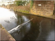
Buckling ice, Grand Western Canal
Ice buckling beneath the former swing bridge from which [[2194948]] was taken.... more
Gate by Grand Western Canal
Looking across the frozen canal. Behind is a valley side; the embanked canal... more
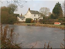
House by the Grand Western Canal
The appropriately-named Water Side is just to the west of Rock Bridge. The canal... more
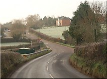
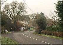
Entering Halberton
The road from Sampford Peverell descends from crossing Rock Bridge and bends past... more
Brown's Bridge Lane
A no through lane leading to about half a dozen properties across the dismantled... more
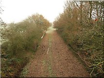
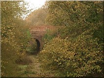
Dismantled railway
The dismantled Tiverton branch of the Bristol and Exeter Railway, seen from... more
Brown's Bridge Lane
From the side of Brown's Bridge, looking along the northern arm of the no through... more
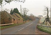
Willand Road
The road from Halberton passes some slightly ruinous outhouses at Slough Farm.
Willand Road
The road bends upwards to cross a ridge; [[151077]] is close by on the left.
Track across meadow, Willand
Seen from Willand Road as it crosses the valley of the Spratford Stream on a... more
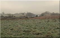
M5 from Lloyd Maunder Road
Headlights are on in the gloom of a frosty winter afternoon. The motorway is seen... more
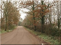
Deanhill Road
The road runs parallel to the stretch of railway line shown in [[1065152]], by the... more
All images © Derek Harper and available under a
Creative Commons licence  .
.