More: Keyword Search · Over Time · Browse Page · OS Map · D-block · Browser ·
Images near:
Add Keyword Filter ⮟Matched Location: Clachbreck / NR7675, Argyll and Bute, Scotland
Showing nearby results, alternatively: 59 Images nearest Clachbreck, Argyll and Bute

About 1,748 photos within 10km of NR7675
Within 1 km
NR7575 : Beach at Tighnahoran by David Lally
NR7575 : Road (B8024) beside the shore of Loch Caolisport by Peter Wood
NR7575 : Shore of Loch Caolisport by Alpin Stewart
NR7575 : Beach at Tighnahoran by David Lally
NR7575 : Beach at Tighnahoran, Loch Caolisport by Alan Reid
NR7675 : Achahoish Primary School by Alpin Stewart
NR7675 : Achahoish Primary School by Gordon Brown
NR7575 : Groyne and Loch Caolisport by Jonathan Wilkins
NR7675 : Achahoish Primary School by Patrick Mackie
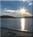
NR7675 : Sunset over Loch Caolsport by Johnny Durnan
NR7675 : Road (B8024) at Tighnahoran by Peter Wood
NR7575 : Shoreline at Loch Caolisport by Gordon Brown
NR7575 : Foreshore, Loch Caolisport by Patrick Mackie
NR7675 : Sunset over Loch Caolsport by Johnny Durnan
NR7575 : Loch Caolisport by David Purchase
NR7674 : Lochan Creige by Patrick Mackie
NR7574 : Ballyaurgan by Anne Burgess
NR7575 : Loch Caolisport by Anne Burgess
NR7675 : Sunset on the shore of Loch Caolsport by Johnny Durnan
NR7675 : Beach at Tighnahoran by Alan Reid
NR7574 : Cliff Rescue Practice near Ballyaurgan by Steve Partridge
NR7675 : Telephone box and cattle grid by David Lally
NR7675 : Shoreline Loch Caolsport by Johnny Durnan
NR7674 : Forestry in South Knapdale by Patrick Mackie
Within 2 km
NR7574 : Ballyaurgan by Patrick Mackie
NR7675 : The B8024 by David Lally
NR7475 : Loch Caolisport by Patrick Mackie
NR7475 : Sea-carved rocks by Patrick Mackie
NR7475 : Shore of Loch Caolisport by Patrick Mackie
NR7574 : B8024 near Ballyaurgan by Alpin Stewart
NR7775 : Creag nan Cuilean by Patrick Mackie
NR7574 : Road (B8024) heading towards Ballyaurgan by Peter Wood
NR7774 : Hill track by Patrick Mackie
NR7676 : Meadow by Baraniongart Burn by Patrick Mackie
NR7673 : Track junction by Patrick Mackie
NR7474 : Track leaving the B8024 and heading towards Druim Buidhe by Peter Wood
NR7676 : B8024 by the turning for Leum Mhic Mhaoilein by Alpin Stewart
NR7676 : Minor road to Leum Mhic Mhaoilein crossing a bridge over Baranlongart Burn by Peter Wood
NR7775 : Hill track by Patrick Mackie
NR7775 : Clachbreck by Patrick Mackie
NR7474 : A gate with a view by Patrick Mackie
NR7673 : Moorland north-east of Cnoc à Phrop by Patrick Mackie
NR7573 : Moorland on Cnoc à Phrop by Patrick Mackie
NR7474 : B8024 north of Baile Boidheach by Alpin Stewart
NR7573 : Cnoc à Phrop by Patrick Mackie
NR7776 : Bridge over the Barnlongart Burn by Alpin Stewart
NR7474 : Rushy field by Patrick Mackie
NR7576 : Rubha Garbh by Jonathan Wilkins
NR7576 : Eilean na h-Uamhaidh, in Loch Caolisport by David Purchase
NR7775 : Dam on Loch a' Chaorainn by Patrick Mackie

only first 50 images shown. Use the links below to explore more. This is a selection of photos centred on the geographical midpoint of the grid reference you have entered. Our coverage of different areas will vary


About 1,748 photos within 10km. Explore these images more: in the Browser (On Map) or in the standard search.
Too many photos in a small area? Try a sample selection of the general area. (On a map)

Search within these images, keywords:

Geographical Contexts for these images (click to view more images): · Estuary, Marine[9] · Coastal[8] · Roads, Road transport[12] · Woodland, Forest[7] · Lowlands[5] · Educational sites[3] · Village, Rural settlement[1] · Farm, Fishery, Market Gardening[3] · Communications[1] · Paths[1] · Rivers, Streams, Drainage[2] · Geological interest[1] · Rocks, Scree, Cliffs[1] · Islands[1]

You are not logged in login | register
About 1,748 photos within 10km. Explore these images more: in the Browser (On Map) or in the standard search.