More: Keyword Search · Over Time · Browse Page · OS Map · D-block · Browser ·
Images near:
Add Keyword Filter ⮟Matched Location: Downhill/NZ3559, Sunderland, England
Showing nearby results, alternatively: Images tagged with [place:Downhill] · 32 Images nearest Downhill/NZ3559, Sunderland

About 12,369 photos within 10km of NZ3559
Within 1 km
NZ3559 : Houses on Washington Road by JThomas
NZ3559 : Looking east on Washington Road by JThomas
NZ3459 : Washington Road by JThomas
NZ3559 : Bedale Crescent, Downhill by Richard Webb
NZ3559 : This bit's flat by Richard Webb
NZ3459 : Houses on Baltimore Avenue by JThomas
NZ3458 : A19 Looking north by Russel Wills
NZ3458 : South-bound Boxing Day traffic on the A19 near Hylton Castle by Philip Barker
NZ3459 : A19  near Nissan motor works by JThomas
NZ3558 : Play area, Cricklewood Road, Hylton Castle by Alex McGregor
NZ3458 : Ferryboat Lane by JThomas
NZ3558 : Cranleigh Road, Hylton Castle Estate by David Dixon
NZ3458 : Houses on Ferryboat Lane by JThomas
NZ3558 : New houses, Swan Court, Hylton Castle by Alex McGregor
NZ3558 : Hylton Castle Medical Centre by MSX
NZ3558 : Hylton Castle by Weston Beggard
NZ3558 : Old Chapel by Weston Beggard
NZ3458 : Hangars and Aircraft by Steve McShane
NZ3458 : North East Aircraft Museum by Steve McShane
NZ3459 : Saturday Afternoon above the A19 by Steve McShane
NZ3459 : Town End by Steve McShane
NZ3559 : Bradshaw Street by Weston Beggard
NZ3559 : The Eponymous Gradient by MSX
NZ3559 : Shops in Downhill by Weston Beggard
NZ3559 : Downhill Park by MSX
NZ3558 : Hylton Castle by David Dixon
NZ3558 : Hylton Castle, Hylton Dene by David Dixon
NZ3558 : Hylton Castle, Sunderland by Brian Deegan
NZ3459 : Boston Crescent, Town End Farm by Alex McGregor
NZ3558 : St Catherine’s Chapel by Richard Webb
NZ3458 : Up, Up and Away by Steve McShane
NZ3558 : Washington Road by Richard Webb
NZ3458 : Nissan Motor Works from the Air by Donald Brydon
NZ3559 : Kentucky Road, Downhill by Malc McDonald
NZ3458 : Castletown, Ferryboat Lane by David Dixon
Within 2 km
NZ3459 : Fields north of Town End Farm by Alex McGregor
NZ3560 : Path on Boldon Hills by Anthony Foster
NZ3659 : The Duck & Kangaroo by Alex McGregor
NZ3457 : New housing, Tollerton Drive, Castletown by JThomas
NZ3560 : Northern Boundary Route at Downhill by Malc McDonald
NZ3359 : A1290, Sunderland by JThomas
NZ3359 : Close up, Elizabeth II postbox on the A1290 by JThomas
NZ3560 : City of Sunderland boundary, Hylton Lane by Malc McDonald
NZ3359 : Elizabeth II postbox on the A1290 by JThomas
NZ3457 : A19 North of Sunderland by Russel Wills
NZ3358 : The local pub! by Steve McShane
NZ3459 : Urban fringe farming by Richard Webb
NZ3457 : Office block on Ferryboat Lane by JThomas
NZ3457 : Ringway, Castletown by JThomas
NZ3358 : Washington Road by JThomas

only first 50 images shown. Use the links below to explore more. This is a selection of photos centred on the geographical midpoint of the grid reference you have entered. Our coverage of different areas will vary


About 12,369 photos within 10km. Explore these images more: in the Browser (On Map) or in the standard search.
Too many photos in a small area? Try a sample selection of the general area. (On a map)

Search within these images, keywords:

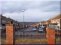
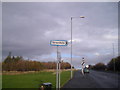
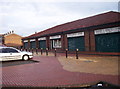
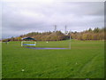
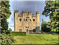
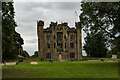
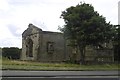
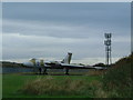
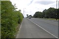
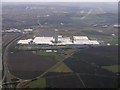
Geographical Contexts for these images (click to view more images): · Housing, Dwellings[7] · Roads, Road transport[11] · Suburb, Urban fringe[7] · Lowlands[2] · Grassland[3] · Business, Retail, Services[6] · Woodland, Forest[3] · Park and Public Gardens[1] · Construction, Development[1] · Historic sites and artefacts[4] · Religious sites[1] · Derelict, Disused[1] · Energy infrastructure[1] · Paths[2] · Boundary, Barrier[2] · Communications[3] · Farm, Fishery, Market Gardening[1]

You are not logged in login | register
About 12,369 photos within 10km. Explore these images more: in the Browser (On Map) or in the standard search.