More: Keyword Search · Over Time · Browse Page · OS Map · D-block · Browser ·
Images near:
Add Keyword Filter ⮟

About 7,072 photos within 10km of NU1008011348
Within 0.3 km
NU1011 : Learchild Crossing Cottage by Les Hull
NU1011 : Learchild Crossing Cottage by Russel Wills
NU1011 : Learchild Crossing Cottage by Les Hull
NU1011 : Approaching Learchild Crossing Cottage by Russel Wills
NU0911 : Path of Disused Railway Line, Learchild Crossing Cottage by Les Hull
NU0911 : The Coe Burn flows through culvert by Russel Wills
Within 0.6 km
NU1011 : Low Learchild (Edlingham) by Les Hull
NU1011 : Route of the dismantled Alnwick to Cornhill Railway by Russel Wills
NU0911 : Trackbed of the Alnwick & Cornhill Railway by Russel Wills
NU1010 : Ford through the Coe Burn by Russel Wills
NU1010 : Ford through The Coe Burn by Les Hull
NU1011 : Hillhead Tunnel by Mark Hatton
NU1011 : Farmland near Edlingham (2) by Stephen Richards
NU1011 : Path and Track towards Garmintedge Bank 98 by Les Hull
NU1011 : Looking out of the northern portal of Hillhead Tunnel by James T M Towill
Within 1.0 km
NU1011 : Round bales, Garmintedge Bank by Richard Webb
NU1011 : Wind sculpted thorn, Hill Head by Richard Webb
NU1012 : Marshy land by Russel Wills
NU1010 : Air Shaft by Peter McDermott
NU1010 : Sheep in pasture beside Air Shaft by Russel Wills
NU1011 : Round bales, Garmintedge Bank by Richard Webb
NU1012 : Garmintedge Bank by Alex McGregor
NU0911 : Thrunton Lowfield Farm by Oliver Dixon
NU1012 : Garmintedge Bank by Richard Webb
NU0912 : Jockysdike Bridge by Russel Wills
NU0912 : Jockysdike Bridge by David Clark
NU1010 : Air shaft by Russel Wills
NU0912 : Jockysdike Bridge by David Clark
NU1010 : An air shaft within Hillhead Tunnel by James T M Towill
NU1012 : Low Broomepark by Richard Webb
NU1010 : Light at the end of the tunnel by James T M Towill
NU1011 : Arable farmland by Walter Baxter
NU1010 : Hill Head farm by Russel Wills
NU1010 : Hill Head by Russel Wills
NU0912 : Coe Burn  by Russel Wills
NU0911 : A grass crop, Thrunton by Richard Webb
NU1010 : Devil's Causeway (Bridleway) towards Birsley Woodside by Les Hull
NU0912 : Pasture by Walter Baxter
NU1010 : Edlingham Railway Tunnel by Dean Allison
NU1010 : The southern portal of Hillhead Tunnel by James T M Towill
NU0912 : Coe Burn by Oliver Dixon
NU1011 : Country road near Bolton (3) by Stephen Richards
NU0911 : A697 by Richard Webb
NU0911 : The A697 near Thrunton by Walter Baxter
NU0911 : A697 northbound by Alex McGregor
NU0911 : Whittingham : A697 by Lewis Clarke
NU0910 : Whittingham : A697 by Lewis Clarke
NU0910 : High Learchild Farm by Oliver Dixon
NU0910 : The minor road from Thrunton joins the A697 by Russel Wills

only first 50 images shown. Use the links below to explore more. This is a selection of photos centred on the geographical midpoint of the grid reference you have entered. Our coverage of different areas will vary


About 7,072 photos within 10km. Explore these images more: in the Browser (On Map) or in the standard search.
Too many photos in a small area? Try a sample selection of the general area. (On a map)

Search within these images, keywords:

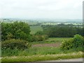
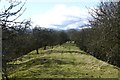
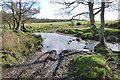
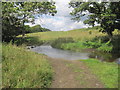
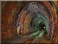
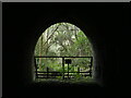
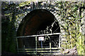
Geographical Contexts for these images (click to view more images): · Uplands[13] · Railways[14] · Grassland[12] · Village, Rural settlement[5] · Derelict, Disused[11] · Lowlands[9] · Woodland, Forest[5] · Rivers, Streams, Drainage[6] · Historic sites and artefacts[6] · Farm, Fishery, Market Gardening[12] · Paths[3] · Roads, Road transport[10] · Energy infrastructure[1] · Lakes, Wetland, Bog[1]

You are not logged in login | register
About 7,072 photos within 10km. Explore these images more: in the Browser (On Map) or in the standard search.