More: Over Time · Browse Page · OS Map · D-block · Browser · Coverage Map ·
Images near:
Add Keyword Filter ⮟

About 3,438 photos within 10km of NY1973342519
Within 0.01 km
NY1942 : Ordnance Survey Cut Mark by Peter Wood
NY1942 : All Saints church, Allhallows, Mealsgate by David Purchase
NY1942 : All Saints Church, Allhallows, Mealsgate - October 2017 (3) by The Carlisle Kid
NY1942 : All Saints Church, Allhallows, Mealsgate - October 2017 (2) by The Carlisle Kid
Within 0.1 km
NY1942 : All Saints Church, Allhallows, Mealsgate by Alexander P Kapp
NY1942 : All Saints Church, Allhallows, Mealsgate, War Memorial by Alexander P Kapp
NY1942 : All Saints Church, Allhallows, Mealsgate - October 2017 (1) by The Carlisle Kid
NY1942 : All Saints Church, Allhallows, Mealsgate - October 2017 (4) by The Carlisle Kid
NY1942 : All Saints Church, Allhallows, Mealsgate, Graveyard by Alexander P Kapp
NY1942 : All Saints Church, Allhallows, Mealsgate by Alexander P Kapp
NY1942 : Allhallows Church, Fletchertown by Nigel Monckton
Within 0.3 km
NY1942 : Tree-line track and footpath to Leesrigg Farm by Peter Wood
Within 0.6 km
NY1942 : The road to Fletchertown by David Purchase
Within 1 km
NY2041 : Old Allhallows churchyard by Ed Messenger
NY2041 : Old Church Mealsgate by Bob Jenkins
NY2041 : Old Graveyard, Mealsgate by Bob Jenkins
NY2041 : Old Allhallows Church by Ed Messenger
NY1843 : Hedge-lined minor road passing through farmland near Watchhill by Peter Wood
NY2042 : Crossroads, Fletchertown. by Nigel Monckton
NY1842 : Hedge-lined minor road approaching Watchhill by Peter Wood
NY2042 : Direction Sign – Signpost near Flethchertown by B Todd
NY2043 : Playing field, Fletchertown by Peter Wood
NY1842 : Old Direction Sign - Signpost by the B5299, Watchhill, Allhallows parish by Milestone Society
Within 2 km
NY2042 : The B5299 through Fletchertown by David Purchase
NY2042 : Ordnance Survey Cut Mark by Peter Wood
NY2043 : Road approaching Crummock Close, Fletchertown by Peter Wood
NY1943 : Hedge-lined minor road passing through farmland near Crookdake by Peter Wood
NY1842 : Watchhill, nr Aspatria by Nigel Monckton
NY2043 : View across open country towards Crookdake by Nigel Monckton
NY2043 : Cummock Place by Alexander P Kapp
NY2042 : Fletchertown Methodist Church by Alexander P Kapp
NY2042 : B5299 near Mealsgate by Steven Brown
NY2042 : Road and housing, Fletchertown by Peter Wood
NY1943 : Crookdake. by John Holmes
NY2041 : The old A595 near Mealgate by David Purchase
NY2043 : Minor road near Fletchertown by Steven Brown
NY2043 : The road to Fletchertown by David Purchase
NY2041 : Gate House of Whitehall by James Emmans
NY2042 : Road junction by Alexander P Kapp
NY1943 : Crookdake by David Purchase
NY1843 : Scalegill woods far left. by John Holmes
NY1941 : Track to Harbybrow by Bob Jenkins
NY2143 : Fletchertown from the end of the track. by John Holmes
NY2143 : Barred gate. by John Holmes
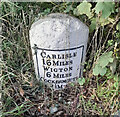
NY2041 : Old Milestone by the A595, east of Aldersceugh by CF Smith
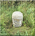
NY2041 : Old Milestone by the A595, east of Aldersceugh by Barbara Todd
NY1943 : Crookdake Farm by John Lord
NY1941 : The track to Aldersceugh by David Purchase
NY1943 : Outbuildings at Crookdake Farm by John Lord

only first 50 images shown. Use the links below to explore more. This is a selection of photos centred on the geographical midpoint of the grid reference you have entered. Our coverage of different areas will vary


About 3,438 photos within 10km. Explore these images more: in the Browser (On Map) or in the standard search.
Too many photos in a small area? Try a sample selection of the general area. (On a map)

Search within these images, keywords:

Geographical Contexts for these images (click to view more images): · Historic sites and artefacts[7] · Religious sites[8] · Boundary, Barrier[4] · Sport, Leisure[2] · Farm, Fishery, Market Gardening[6] · Roads, Road transport[14] · Flat landscapes[6] · Lowlands[4] · Village, Rural settlement[8] · Derelict, Disused[3] · Burial ground, Crematorium[1] · Grassland[1] · Housing, Dwellings[3] · Country estates[1] · Paths[1]
You are not logged in | login | register
About 3,438 photos within 10km. Explore these images more: in the Browser (On Map) or in the standard search.