More: Keyword Search · Over Time · Browse Page · OS Map · D-block · Browser ·
Images near:
Add Keyword Filter ⮟

About 12,523 photos within 10km of NY9890769558
Within 0.1 km
NY9869 : Looking towards Little Whittington Farm by Ian Paterson
Within 0.3 km
NY9869 : Farmland north of Whittington Dene (2) by Mike Quinn
NY9969 : Little Whittington by Peter McDermott
NY9869 : Farmland north of Whittington Dene by Mike Quinn
Within 0.6 km
NY9869 : The River Pont by Christine Johnstone
NY9869 : Flowery ridge and furrow by Christine Johnstone
NY9869 : Farmland east of Grottington Cottages by Mike Quinn
NY9869 : Sheep grazing by Christine Johnstone
NY9869 : Dere Street [A68] by Christine Johnstone
NY9969 : Pastures near Little Whittington by Mike Quinn
NY9869 : Espresso and gelateria and burger van near the Roman Wall by David Hawgood
NY9869 : Big Al's by Oliver Dixon
NY9869 : A68 towards Jedburgh by JThomas
NY9869 : Bales storage area beside A68 (2) by Trevor Littlewood
NY9869 : Bale storage area beside A68 by Trevor Littlewood
NY9869 : A68 near Grottington Cottages by Colin Pyle
NY9869 : Farmland towards Little Whittington by JThomas
NY9869 : Pasture by Whittington Fell by David Hawgood
NY9869 : A68 heading north by JThomas
Within 1.0 km
NY9969 : Pastures near Little Whittington (2) by Mike Quinn
NY9869 : Farmland north of the River Pont by Mike Quinn
NY9868 : A68 nearing Port Gate roundabout by Colin Pyle
NY9969 : Grazing land between High Baulk and Little Whittington (3) by Mike Quinn
NY9869 : Farmland and woodland west of Grottington Cottages by Mike Quinn
NY9969 : Grazing land between High Baulk and Little Whittington by Mike Quinn
NY9969 : Grazing land between High Baulk and Little Whittington (2) by Mike Quinn
NY9868 : Roundabout at the junction of the A68 and B6318 roads by Peter Wood
NY9868 : Stagshaw Roundabout by G Laird
NY9969 : Pastures near High Baulk (2) by Mike Quinn
NY9868 : Walking east at Port Gate by Ian S
NY9869 : The River Pont by Mike Quinn
NY9969 : Pastures near High Baulk by Mike Quinn
NY9868 : (The site of)  Roman Portgate by Mike Quinn
NY9868 : Ordnance Survey Flush Bracket 2393 by Peter Wood
NY9868 : Hadrian's Wall Path west of Milecastle 22 by Mike Quinn
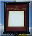
NY9868 : The Errington Arms on the A68 by Ian S
NY9868 : Sign for The Errington Arms by Mike Quinn
NY9868 : Sign for the Errington Arms, Stagshaw by JThomas
NY9868 : The Errington Arms by Mike Quinn
NY9868 : Faded sign for the Errington Arms, Stagshaw by JThomas
NY9868 : The Errington Arms by Mike Quinn
NY9868 : The Errington Arms at the junction of the A68 and B6318 by Alexander P Kapp
NY9868 : The Errington Arms on the A68 by Ian S
NY9868 : The Errington Arms at Port Gate by Andrew Curtis
NY9868 : Errington Arms, Port Gate by Ian S
NY9868 : Realignment of the Military Road east of Port Gate roundabout by Andrew Curtis
NY9868 : The Errington Arms, Stagshaw by JThomas
NY9868 : The Errington Arms from Hadrian's Wall Path by Anthony Parkes
NY9868 : Fawdington's Garage, Stagshaw by Les Hull
NY9868 : Port Gate by Oliver Dixon

only first 50 images shown. Use the links below to explore more. This is a selection of photos centred on the geographical midpoint of the grid reference you have entered. Our coverage of different areas will vary


About 12,523 photos within 10km. Explore these images more: in the Browser (On Map) or in the standard search.
Too many photos in a small area? Try a sample selection of the general area. (On a map)

Search within these images, keywords:

Geographical Contexts for these images (click to view more images): · Uplands[9] · Farm, Fishery, Market Gardening[10] · Rivers, Streams, Drainage[4] · Woodland, Forest[3] · Housing, Dwellings[1] · Business, Retail, Services[13] · Roads, Road transport[9] · Lowlands[1] · Rocks, Scree, Cliffs[1] · Village, Rural settlement[1] · Paths[4] · Historic sites and artefacts[3] · Sport, Leisure[2] · Grassland[1]

You are not logged in login | register
About 12,523 photos within 10km. Explore these images more: in the Browser (On Map) or in the standard search.