More: Keyword Search · Over Time · Browse Page · OS Map · D-block · Browser ·
Images near:
Add Keyword Filter ⮟

About 3,890 photos within 10km of SD1946069944
Within 0.01 km
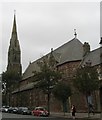
SD1969 : St James Church, Barrow-in-Furness by Stephen Middlemiss
Within 0.1 km
SD1969 : St James the Great, Barrow-in-Furness: mid-February 2015 by Basher Eyre
SD1969 : St James the Great Church,  Barrow by Alexander P Kapp
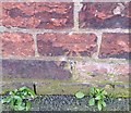
SD1969 : Ordnance Survey Cut Mark by Adrian Dust
SD1969 : Seats in Hartington Street by Rosalind Mitchell
SD1970 : Melbourne Street by Rosalind Mitchell
Within 0.3 km
SD1970 : Holker Street by Rosalind Mitchell
SD1969 : Ordnance Survey Cut Mark by Adrian Dust
SD1970 : Ordnance Survey Cut Mark by Adrian Dust
SD1970 : Houses on Holker Street, Barrow-in-Furness by JThomas
SD1969 : Bath Street, Hindpool by Alex McGregor
SD1970 : Holker Street by Rosalind Mitchell
SD1970 : Ordnance Survey Cut Mark by Adrian Dust
SD1970 : Barrow sidings by Stephen Craven
SD1970 : Barrow-in-Furness : Walney Road A590 by Lewis Clarke
Within 0.6 km
SD1969 : Barrow-in-Furness : Walney Road A590 by Lewis Clarke
SD1969 : Bath Street, Hindpool by Alex McGregor
SD1969 : Hartington Street by Rosalind Mitchell
SD1970 : Barrow Depot by Peter Trimming
SD1970 : Sidings near Barrow-in-Furness Railway Station by JThomas
SD1970 : Railway yard and signal box viewed from north end of Barrow Station by Roger Templeman
SD1969 : Ordnance Survey Cut Mark by Adrian Dust
SD1969 : The Ambrose Hotel, Duke Street, Barrow-in-Furness by Alexander P Kapp
SD1969 : Willie Horne by Rosalind Mitchell
SD1969 : Nelson Street, Hindpool by Rosalind Mitchell
SD1969 : Barrow-in-Furness : Blake Street by Lewis Clarke
SD1970 : Barrow in Furness signal box by Raymond Knapman
SD1969 : St Mary of Furness Church at Barrow-in-Furness by Gerald Massey
SD1969 : Vernon Street, Hindpool, Barrow-in-Furness by Christine Johnstone
SD1969 : St. Mary of Furness Church at Barrow-in-Furness by Gerald Massey
SD1969 : St Mary's RC Church by Rosalind Mitchell
SD1969 : St Mary of Furness Church at Barrow-in-Furness by Gerald Massey
SD1969 : Army Reserve Centre on Holker Street, Barrow-in-Furness by JThomas
SD1969 : Hartington Street, Hindpool, Barrow-in-Furness by Christine Johnstone
SD1970 : Barrow signal box & carriage sidings by Ian Taylor
SD1970 : Barrow Signal Box by Peter Trimming
SD1970 : Barrow-in-Furness signal box by JThomas
SD1970 : Barrow-in-Furness Railway Station by JThomas
SD1969 : Barrow-in-Furness scene by Eirian Evans
SD1969 : Ordnance Survey Cut Mark by Adrian Dust
SD1970 : Railway signal, Barrow-in-Furness Station by Adrian Taylor
SD1969 : Barrow Station by Rosalind Mitchell
SD1969 : Barrow-in-Furness Railway Station by JThomas
SD1969 : The end of the platforms at Barrow by Jonathan Thacker
SD1969 : Craven Park by Rosalind Mitchell
SD1969 : Railway Station by Wayland Smith
SD1970 : Northern Rail Service to Lancaster stops at Barrow-in-Furness by Andy Deacon
SD1969 : Hawke Street, at the junction with Bath Street by Christine Johnstone

only first 50 images shown. Use the links below to explore more. This is a selection of photos centred on the geographical midpoint of the grid reference you have entered. Our coverage of different areas will vary


About 3,890 photos within 10km. Explore these images more: in the Browser (On Map) or in the standard search.
Too many photos in a small area? Try a sample selection of the general area. (On a map)

Search within these images, keywords:

Geographical Contexts for these images (click to view more images): · Religious sites[5] · City, Town centre[6] · Historic sites and artefacts[7] · Housing, Dwellings[6] · Suburb, Urban fringe[5] · Roads, Road transport[5] · Railways[12] · Defence, Military[1] · Coastal[1] · Public buildings and spaces[1]

You are not logged in login | register
About 3,890 photos within 10km. Explore these images more: in the Browser (On Map) or in the standard search.