More: Keyword Search · Over Time · Browse Page · OS Map · D-block · Browser ·
Images near:
Add Keyword Filter ⮟

About 6,648 photos within 10km of SD694645
Within 0.01 km
SD6964 : Trig Pillar Burn Moor by Michael Graham
Within 0.1 km
SD6964 : Trig Point on Burn Moor (2) by Chris Heaton
SD6964 : Trig Point on Burn Moor (1) by Chris Heaton
SD6964 : Trig Pillar Burn Moor by Tom Richardson
SD6964 : You can see the Three Peaks from here by Karl and Ali
SD6964 : Trig  pillar, Burn Moor by David Brown
SD6964 : View to the Summit Area of Burn Moor by Trevor Littlewood
SD6964 : Burn Moor Fell Trig by Rude Health
Within 0.3 km
SD6964 : Standard on Burn Moor by Michael Graham
SD6964 : Gate on Burn Moor by Chris Heaton
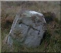
SD6964 : Old Boundary Marker on Burn Moor, Tatham Parish by Milestone Society
SD6964 : Standard on Burn Moor by Chris Heaton
SD6964 : Two faces of the Standard on Burn Moor by Karl and Ali
SD6964 : The south face of the Standard on Burn Moor by Karl and Ali
SD6964 : Cairn at West Cat Stones by Karl and Ali
SD6964 : Possible predator trap, West Cat Stones (4) by Karl and Ali
SD6964 : Possible predator trap, West Cat Stones (3) by Karl and Ali
SD6964 : Possible predator trap, West Cat Stones (2) by Karl and Ali
SD6964 : Possible predator trap, West Cat Stones by Karl and Ali
Within 0.6 km
SD6964 : Old Boundary Marker by East Cat Stones, Burn Moor, Tatham parish by Milestone Society
SD6964 : East Cat Stones Burn Moor by Tom Richardson
SD6864 : Fellside below Burn Moor by Tom Richardson
Within 1.0 km
SD6963 : Fence and Broken Wall on Burn Moor by Chris Heaton
SD6965 : Boundary Fence on Burn Moor by Chris Heaton
SD6864 : Davidson's Crag by Karl and Ali
SD6963 : Walking Over Burn Moor by Rude Health
SD6965 : The northern slopes of Burn Moor by Karl and Ali
SD6963 : Cantsfield Dike Nook? by Chris Heaton
SD6963 : Fence over Burn Moor by Michael Graham
SD6965 : Fence and Gate Burn Moor by Tom Richardson
SD7064 : Cairn on Burn Moor Fell by Tom Richardson
SD6863 : Looking North West from Master Close by Chris Heaton
Within 2 km
SD6864 : Crossdale Grains by David Brown
SD6864 : Crossdale Graines by SIMON PHILLIPS
SD6864 : Higher Crossdale Grains by Peter McDermott
SD6963 : Old Boundary Marker on Middlesmoor, Tatham Parish by Milestone Society
SD6965 : Burn Moor by Michael Graham
SD7065 : Alder Gill Syke by Michael Graham
SD6865 : Shooting box, Burn Moor by David Brown
SD6865 : Shooting Box And Shooter's Table by Rude Health
SD6865 : Burn Moor by SIMON PHILLIPS
SD6865 : Shooting Hut below Burn Moor by Chris Heaton
SD6865 : Shooting Hut Burn Moor by Tom Richardson
SD6863 : Tributary of Crossdale Beck by Chris Heaton
SD6963 : Old Boundary Marker on Middlesmoor, Tatham Parish by Milestone Society
SD6865 : Shooting Hut Burn Moor by Michael Graham
SD7063 : Outlaw Gill Syke by Michael Graham
SD6864 : Moorland North of Higher Croasdale Grains (2) by Chris Heaton
SD7065 : Abandoned shooting hut by Tom Richardson

only first 50 images shown. Use the links below to explore more. This is a selection of photos centred on the geographical midpoint of the grid reference you have entered. Our coverage of different areas will vary


About 6,648 photos within 10km. Explore these images more: in the Browser (On Map) or in the standard search.
Too many photos in a small area? Try a sample selection of the general area. (On a map)

Search within these images, keywords:

Geographical Contexts for these images (click to view more images): · Uplands[26] · Moorland[21] · Historic sites and artefacts[5] · Boundary, Barrier[2] · Rocks, Scree, Cliffs[3] · Sport, Leisure[9] · Derelict, Disused[3] · Country estates[2] · Housing, Dwellings[1] · Paths[1]

You are not logged in login | register
About 6,648 photos within 10km. Explore these images more: in the Browser (On Map) or in the standard search.