More: Keyword Search · Over Time · Browse Page · OS Map · D-block · Browser ·
Images near:
Add Keyword Filter ⮟

About 10,468 photos within 10km of ST059748
Within 0.6 km
ST0574 : Zoar Presbyterian Chapel by Tony Hodge
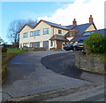
ST0574 : Greenway Farm Barn Conversions by Tony Hodge
ST0574 : Zoar Presbyterian Chapel, Bonvilston by Tony Hodge
ST0574 : Crossways Junction by Guy Butler-Madden
Within 1.0 km
ST0674 : Red Lion, Bonvilston by Tony Hodge
ST0674 : Bonvilston Village Green by Tony Hodge
ST0675 : Lane down to Pendoylan by Mick Lobb
ST0575 : Lane east of Hensol Forest by Colin Pyle
ST0675 : Entrance to Caerwigau Uchaf Farm by Mick Lobb
ST0675 : Farmland around Pendoylan and beyond by Mick Lobb
ST0675 : Caerwigau Uchaf Farm by Alan Hughes
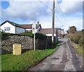
ST0574 : Minor road north of the A48 west of Bonvilston by Jaggery
ST0574 : Lane near Greenway Farm by Colin Pyle
ST0675 : Farmland around Pendoylan and beyond by Mick Lobb
ST0675 : Field gate and view, near Caerwigau Uchaf farm by John Lord
ST0574 : Entrance to New Greenway Farm near Bonvilston by Jaggery
ST0574 : Zoar Church by Alan Hughes
ST0674 : Tudor Lodge, Bonvilston by Jaggery
ST0673 : Bonvilston Village Shop by Guy Butler-Madden
ST0673 : Bonvilston, Old Village Shop by Mike Faherty
ST0573 : Crossroads ahead, A48 in the west of Bonvilston by Jaggery
ST0673 : Village Shop by Alan Hughes
ST0673 : Buttress House, Bonvilston by Jaggery
ST0673 : The Old Laundry, Bonvilston by Jaggery
ST0673 : Redway Road, Bonvilston by Jaggery
ST0673 : Tree presented to Bonvilston in 1954 by Jaggery
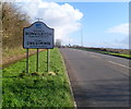
ST0573 : Western boundary of Bonvilston by Jaggery
ST0573 : Farmhouse, Ty Groes Farm, Bonvilston by Jaggery
ST0674 : Church of St Mary, Bonvilston by John Lord
ST0674 : Church of St Mary,  Bonvilston by John Lord
ST0673 : Old Milestone by the A48, Bonvilston by Milestone Society
ST0574 : Greenway Farm near Bonvilston by Jaggery
ST0574 : Zoar Presbyterian Church near Bonvilston by Jaggery
ST0574 : Minor road north to farms and Zoar church near Bonvilston by Jaggery
ST0674 : Entrance to churchyard, Bonvilston by John Lord
ST0573 : Telephone exchange near Bonvilston by Jaggery
ST0574 : Lower Greenway Farm by Alan Hughes
ST0673 : Row of cottages by Alan Hughes
ST0673 : The road to Liege Manor and Tyn-y-coed by David Smith
ST0673 : Bonvilston Village Hall by Guy Butler-Madden
ST0573 : Aubrey Arms, Bonvilston by Alan Hughes
ST0674 : Grade II listed Church of St Mary the Virgin, Bonvilston by Jaggery
ST0674 : Nameboard, Church of St Mary the Virgin Bonvilston by Jaggery
ST0573 : The Old Post near Bonvilston by Jaggery
ST0674 : Pathway through the autumn of our lives by Alan Hughes
ST0674 : Parish Church of St Mary, Bonvilston by Colin Cheesman
ST0674 : St.Mary's Church, Bonvilston by Alan Hughes
ST0674 : Ordnance Survey Cut Mark by Adrian Dust
ST0573 : Aubrey Arms by Steve Barnes

only first 50 images shown. Use the links below to explore more. This is a selection of photos centred on the geographical midpoint of the grid reference you have entered. Our coverage of different areas will vary


About 10,468 photos within 10km. Explore these images more: in the Browser (On Map) or in the standard search.
Too many photos in a small area? Try a sample selection of the general area. (On a map)

Search within these images, keywords:

Geographical Contexts for these images (click to view more images): · Uplands[3] · Farm, Fishery, Market Gardening[6] · Housing, Dwellings[7] · Roads, Road transport[11] · Woodland, Forest[1] · Paths[2] · Village, Rural settlement[20] · Religious sites[7] · Grassland[2] · Lowlands[2] · Business, Retail, Services[4] · Boundary, Barrier[2] · Historic sites and artefacts[2] · Communications[1] · Public buildings and spaces[2] · Sport, Leisure[2] · Burial ground, Crematorium[1]

You are not logged in login | register
About 10,468 photos within 10km. Explore these images more: in the Browser (On Map) or in the standard search.