More: Keyword Search · Over Time · Browse Page · OS Map · D-block · Browser ·
Images near:
Add Keyword Filter ⮟Matched Location: Kings Ripton / TL2676, Cambridgeshire, England
Showing nearby results, alternatively: 61 Images nearest Kings Ripton, Cambridgeshire

About 7,845 photos within 10km of TL2676
Within 1 km
TL2576 : B1090 crossroad by Shaun Ferguson
TL2576 : Crossroads on the B1090, Kings Ripton by David Howard
TL2576 : Crossroads at Kings Ripton by Andrew Tatlow
TL2576 : Grazing, Manor Farm by JThomas
TL2576 : Country road by Alex McGregor
TL2576 : Ramsey Road by JThomas
TL2576 : B1090 towards Abbots Ripton by JThomas
TL2575 : Rural Road towards Huntingdon by JThomas
TL2675 : Path up private road to Glebe Farm by Shaun Ferguson
TL2575 : Farmland south west of Kings Ripton by JThomas
TL2675 : Public footpath and private road by Richard Humphrey
TL2575 : Kings Ripton to Huntingdon Road by Andrew Tatlow
TL2575 : Gated farm track by Shaun Ferguson
TL2676 : Thatched cottages, Kings Ripton by JThomas
TL2676 : School Lane, Kings Ripton by Simon Huguet
TL2576 : Trees and track near Kings Ripton by Richard Humphrey
TL2676 : Ramsey Road, Kings Ripton by JThomas
TL2676 : Thatched cottages on Ramsey Road, Kings Ripton by David Howard
TL2676 : Red, pink and green by Richard Humphrey
TL2676 : St Peter's Church, Kings Ripton by JThomas
TL2676 : St Peter's Church, Kings Ripton by David Howard
TL2676 : Thatched cottage on Ramsey Road, Kings Ripton by David Howard
TL2676 : Ramsey Road, Kings Ripton by Stephen McKay
TL2676 : Kings Ripton Church by Stephen McKay
TL2676 : Stone corbel, St Peter's, Kings Ripton by Simon Huguet
TL2676 : Thatched cottage next to the church, Kings Ripton by Richard Humphrey
TL2676 : St Peter's, Kings Ripton by Simon Huguet
TL2676 : St Peter's Church, Kings Ripton by Bill Henderson
TL2676 : St Peter Kings Ripton by Andrew Tatlow
TL2676 : Priory Cottage Kings Ripton by Andrew Tatlow
TL2676 : St Peter's churchyard with view to thatched cottage beyond by Fractal Angel
TL2675 : Stubble field off the B1090 by JThomas
TL2675 : B1090 heading south east by JThomas
TL2576 : Trees near Kings Ripton at dusk by Simon Barnes
TL2676 : Grass meadow and sewage farm by Michael Trolove
TL2676 : Bury Brook by Shaun Ferguson
TL2676 : Path past Kings Ripton by Hugh Venables
TL2676 : Ramsey Road by Hugh Venables
TL2676 : Entering Kings Ripton by JThomas
TL2675 : Farmland south of King's Ripton by Simon Mortimer
TL2575 : Go Kart track near Huntingdon by Richard Humphrey
Within 2 km
TL2676 : Crop sprayer getting ready by Hugh Venables
TL2676 : Footpath to Kings Ripton by Hugh Venables
TL2676 : Pathfinder trail looking towards Kings Ripton by Michael Trolove
TL2577 : Road to Lodge Farm (footpath) by JThomas
TL2577 : Farmland, Lodge Farm by JThomas
TL2677 : Towards Kings Ripton by Andrew Tatlow
TL2577 : Converted barns at Lodge Farm by Simon Mortimer

only first 50 images shown. Use the links below to explore more. This is a selection of photos centred on the geographical midpoint of the grid reference you have entered. Our coverage of different areas will vary


About 7,845 photos within 10km. Explore these images more: in the Browser (On Map) or in the standard search.
Too many photos in a small area? Try a sample selection of the general area. (On a map)

Search within these images, keywords:

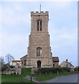
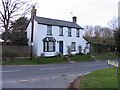
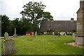
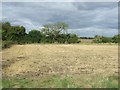
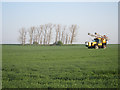
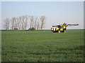
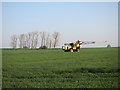
Geographical Contexts for these images (click to view more images): · Roads, Road transport[12] · Farm, Fishery, Market Gardening[15] · Village, Rural settlement[10] · Paths[5] · Housing, Dwellings[3] · Religious sites[3] · Lowlands[2] · Water resources[1] · Waste, Waste management[1] · Rivers, Streams, Drainage[2] · Sport, Leisure[2]

You are not logged in login | register
About 7,845 photos within 10km. Explore these images more: in the Browser (On Map) or in the standard search.