2006
TQ7961 : Arran Bank Farm, Dunn Street
taken 18 years ago, near to Bredhurst, Kent, England
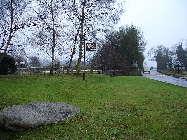
Arran Bank Farm, Dunn Street
Two large sarsen stones guard the entrance to the farm which operates a livery stables. Looking west, the lane moves into the next grid square where the speed restriction ends.
 Map © Crown Copyright")
TIP: Click the map for more Large scale mapping
- Grid Square
- TQ7961, 22 images (more nearby 🔍)
- Photographer
- Penny Mayes (more nearby)
- Date Taken
- Tuesday, 3 January, 2006 (more nearby)
- Submitted
- Tuesday, 3 January, 2006
- Subject Location
-
OSGB36:
 TQ 790 614 [100m precision]
WGS84: 51:19.4439N 0:34.0833E - Camera Location
-
OSGB36: TQ 790 614
- View Direction
- West-southwest (about 247 degrees)