2005
SO6702 : High & Low Level bridges, Sharpness Docks
taken 19 years ago, near to Sharpness, Gloucestershire, England
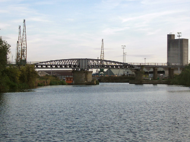
High & Low Level bridges, Sharpness Docks
Sharpness Docks developed after a new dock was constructed in 1870 to accommodate larger vessels which could not pass up the Gloucester & Sharpness canal. The railway lines which crossed these bridges connected to the Great Western and Midland network which provided an alternative to transportation by canal.
The photo was taken from the canal towpath.
The photo was taken from the canal towpath.
 Map © Crown Copyright")
TIP: Click the map for more Large scale mapping
- Grid Square
- SO6702, 125 images (more nearby 🔍)
- Photographer
- Phil Champion (more nearby)
- Date Taken
- Sunday, 21 August, 2005 (more nearby)
- Submitted
- Sunday, 8 January, 2006
- Subject Location
-
OSGB36:
 SO 673 029 [100m precision]
WGS84: 51:43.4316N 2:28.4883W - Camera Location
-
OSGB36: SO 674 030