2004
SW4028 : Brane burial chamber
taken 20 years ago, near to Brane, Cornwall, England
This is 1 of 2 images, with title Brane burial chamber in this square
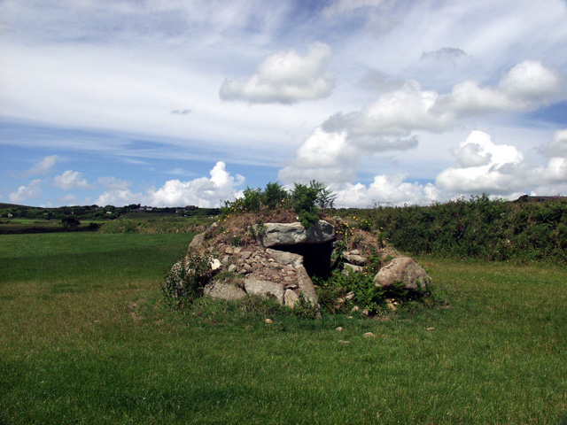
Brane burial chamber
Situated on open farmland, and used as a sheep shelter. From memory, taken looking west.
 Map © Crown Copyright")
TIP: Click the map for more Large scale mapping
- Grid Square
- SW4028, 55 images (more nearby 🔍)
- Photographer
- Alan Simkins (more nearby)
- Date Taken
- August 2004 (more nearby)
- Submitted
- Wednesday, 30 March, 2005
- Subject Location
-
OSGB36:
 SW 401 281 [100m precision]
WGS84: 50:5.8050N 5:38.0854W - Camera Location
-
OSGB36: SW 401 280
- View Direction
- NORTH (about 0 degrees)