2006
ST0134 : Brompton Regis: West Somerset Mineral Railway formation
taken 18 years ago, near to Treborough, Somerset, England
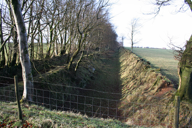
Brompton Regis: West Somerset Mineral Railway formation
A cutting running west from Naked Boys Bridge. The bridge, now filled in, is named after a nearby stone. On the left bank of the cutting a public footpath leads to Burrow Farm Engine House, half a mile away, and built in the 1860s to serve an iron ore mine
 Map © Crown Copyright")
TIP: Click the map for more Large scale mapping
- Grid Square
- ST0134, 50 images (more nearby 🔍)
- Photographer
- Martin Bodman (more nearby)
- Date Taken
- Thursday, 12 January, 2006 (more nearby)
- Submitted
- Thursday, 12 January, 2006
- Subject Location
-
OSGB36:
 ST 0143 3437 [10m precision]
WGS84: 51:6.0079N 3:24.5483W