2008
NZ2763 : North bank of the Tyne, east of St Peter's
taken 15 years ago, near to Byker, Newcastle Upon Tyne, England
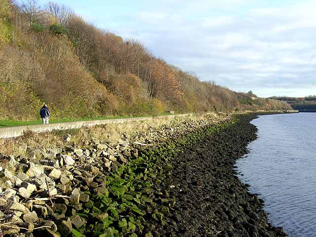
North bank of the Tyne, east of St Peter's
The promenade above the shoreline carries Hadrian's Way which is a largely traffic-free route from western to eastern boundaries of the City of Newcastle-upon-Tyne. The Way is followed by both Hadrian's Wall National Trail Link and by route 72 of the National Cycle Network (Hadrian's Cycleway
Link the Tynemouth branch of the C2C Cycle Route Link.
Link
 Map © Crown Copyright")
TIP: Click the map for more Large scale mapping
- Grid Square
- NZ2763, 89 images (more nearby 🔍)
- Photographer
- Oliver Dixon (more nearby)
- Date Taken
- Tuesday, 18 November, 2008 (more nearby)
- Submitted
- Thursday, 20 November, 2008
- Subject Location
-
OSGB36:
 NZ 277 634 [100m precision]
WGS84: 54:57.9163N 1:34.1147W - Camera Location
-
OSGB36: NZ 276 635
- View Direction
- East-southeast (about 112 degrees)