2008
SX7169 : Fields at Shuttaford
taken 15 years ago, near to Holne, Devon, England
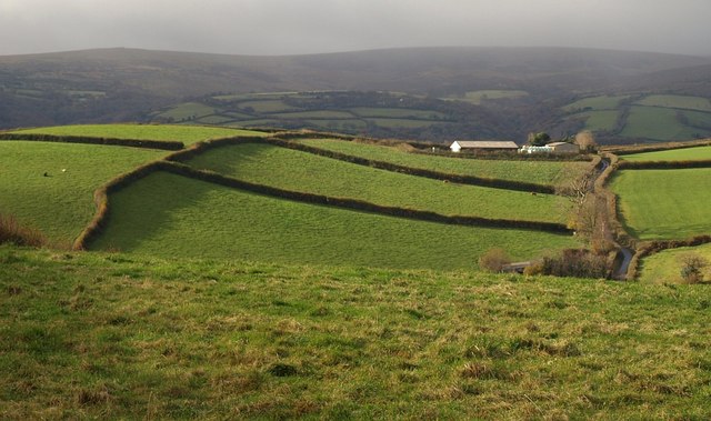
Fields at Shuttaford
On the right, a lane climbs from Shuttaford towards Holne. Seen from the lane shown in SX7269 : Lane at Humphrey's Cross near Staddicombe. In the distance, Dartmoor looms.
 Map © Crown Copyright")
TIP: Click the map for more Large scale mapping
- Grid Square
- SX7169, 47 images (more nearby 🔍)
- Photographer
- Derek Harper (more nearby)
- Date Taken
- Sunday, 16 November, 2008 (more nearby)
- Submitted
- Friday, 21 November, 2008
- Subject Location
-
OSGB36:
 SX 716 690 [100m precision]
WGS84: 50:30.4006N 3:48.7248W - Camera Location
-
OSGB36: SX 7220 6922
- View Direction
- West-southwest (about 247 degrees)