2008
TG3309 : Footpath to Braydeston Church
taken 15 years ago, near to Blofield, Norfolk, England
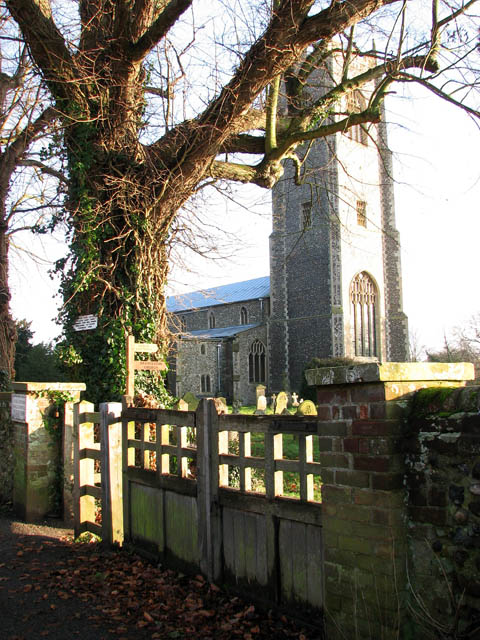
Footpath to Braydeston Church
This public footpath starts at the churchyard gate. Its first section traverses the churchyard surrounding the church of SS Andrew and Peter (seen in the background). After passing a stile > Link and a footbridge > Link over a drain the path leads uphill across fields > Link and onwards until it passes another stile > Link and reaches Braydeston's St Michael's church > Link.
 Map © Crown Copyright")
TIP: Click the map for more Large scale mapping
- Grid Square
- TG3309, 113 images (more nearby 🔍)
- Photographer
- Evelyn Simak (more nearby)
- Date Taken
- Friday, 5 December, 2008 (more nearby)
- Submitted
- Saturday, 6 December, 2008
- Subject Location
-
OSGB36:
 TG 335 091 [100m precision]
WGS84: 52:37.7959N 1:26.9357E - Camera Location
-
OSGB36: TG 334 092
- View Direction
- Southeast (about 135 degrees)