2008
TM0350 : Ploughed field and view of Wattisham Air Base
taken 15 years ago, near to Great Bricett, Suffolk, England
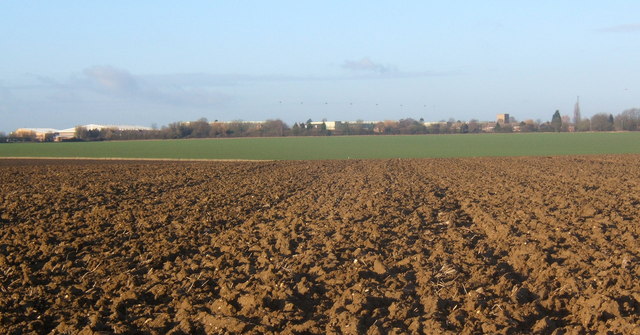
Ploughed field and view of Wattisham Air Base
The field was heavy, wet clay, with a line of tractor tracks marking a route for walkers to Great Bricett which did not match up with the network of paths shown on the map. It was heavy going.
 Map © Crown Copyright")
TIP: Click the map for more Large scale mapping
- Grid Square
- TM0350, 48 images (more nearby 🔍)
- Photographer
- Andrew Hill (more nearby)
- Date Taken
- Saturday, 6 December, 2008 (more nearby)
- Submitted
- Saturday, 6 December, 2008
- Subject Location
-
OSGB36:
 TM 034 503 [100m precision]
WGS84: 52:6.8357N 0:58.2222E - Camera Location
-
OSGB36: TM 036 501
- View Direction
- Northwest (about 315 degrees)