Geograph - photograph every grid square
2004
SH2384
: holyhead breakwater
taken
20 years ago
,
near
to
Holyhead/Caergybi
, Isle of Anglesey/Sir Ynys Mon, Wales
This is 1 of
6 images, with title holyhead breakwater
in this square
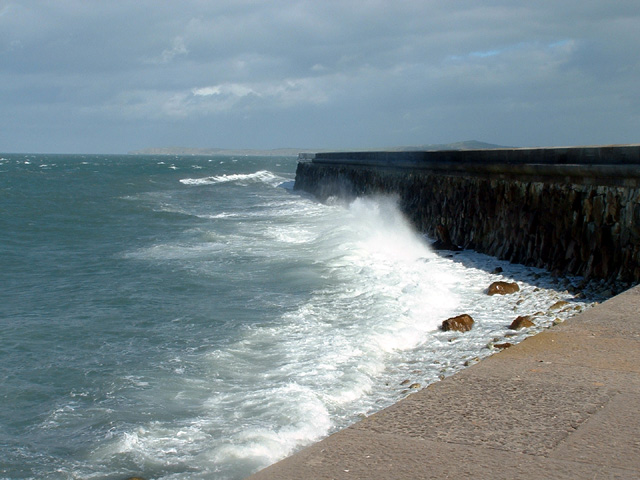
holyhead breakwater
Holyhead breakwater showing the section up to the first bend
© Copyright
Nigel Williams
and licensed for
reuse
under this
Creative Commons Licence
.
Licensing
Download
Share...
Share this photo via Twitter
Share this photo via Facebook
Share this photo via Pinterest
Share this photo via Flipboard
Share this photo via email/e-card
Grab a Stamped/Watermarked Image
Mark
👍🏻
Like Image
👍🏻
Like Description
Update Information
Contact Contributor
Category:
Coast
>
Breakwater
This photo is linked from:
Automatic Clusters
: ·
Holyhead Breakwater [12]
·
Bend [4]
·
Section [2]
Title Clusters
: ·
holyhead breakwater [6]
·
TIP: Click the map for more Large scale mapping
Grid Square
SH2384
, 15 images (
more nearby
🔍
)
Photographer
Nigel Williams
(
more nearby
)
Date Taken
Tuesday, 5 October, 2004 (
more nearby
)
Submitted
Friday, 20 January, 2006
Subject Location
OSGB36:
SH 239 841
[100m precision]
WGS84:
53:19.4666N
4:38.7330W
Camera Location
OSGB36:
SH 238 839
NW
N
NE
W
Go
E
SW
S
SE
Discuss SH2384
View this location on ...
Geograph Coverage Map (includes OSM etc)
Geograph Links Page
Open in Google Maps
Navigate to location with Google Maps
Open in Google Earth Pro
Open in Google Earth for Web
Open in Bing Maps
Navigate with Google Maps
Lookup nearest Postcode
Image classification
(about)
: Geograph
This page has been
viewed
about
90
times
☰
Home
View
Search
Marked Images
Maps
Browser
Explore
Showcase
New Images
Collections
Interact
Games
Discussions
Blog
Contributors
Submit
Statistics
Leaderboards
General
FAQ
Help Pages
Sitemap
Contact Us
Support Us
sponsored by
🔍
What to search:
Photos
Enter keywords or a location/postcode to search nearby images
Photos near SH2384
Enter a Grid Reference
Placenames
Collections
Website Pages
Everything
Others:
Advanced Search
|
Image Browser
Or:
Coverage Map
|
Searchable Map
You are not logged in
login
|
register