2009
TG3603 : Footpath to Cantley
taken 15 years ago, near to Langley Street, Norfolk, England
This is 1 of 2 images, with title Footpath to Cantley in this square
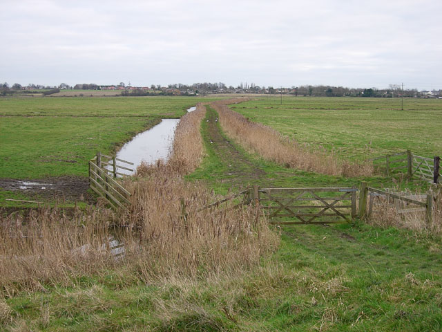
Footpath to Cantley
Starts at the end of Burnt House Lane and cuts across the marshes. The marshes are part of the Buckenham & Cantley Marshes RSPB reserve, which protects them for the wintering Bean Geese - one of only two sites in the country for the Taiga (fabalis) race - and the other wildfowl and wildlife.
 Map © Crown Copyright")
TIP: Click the map for more Large scale mapping
- Grid Square
- TG3603, 25 images (more nearby 🔍)
- Photographer
- Hugh Venables (more nearby)
- Date Taken
- Saturday, 3 January, 2009 (more nearby)
- Submitted
- Sunday, 11 January, 2009
- Subject Location
-
OSGB36:
 TG 369 031 [100m precision]
WGS84: 52:34.4860N 1:29.7581E - Camera Location
-
OSGB36: TG 369 031
- View Direction
- East-northeast (about 67 degrees)