2009
NT1589 : Farmland near Cowdenbeath
taken 15 years ago, near to Hill of Beath, Fife, Scotland
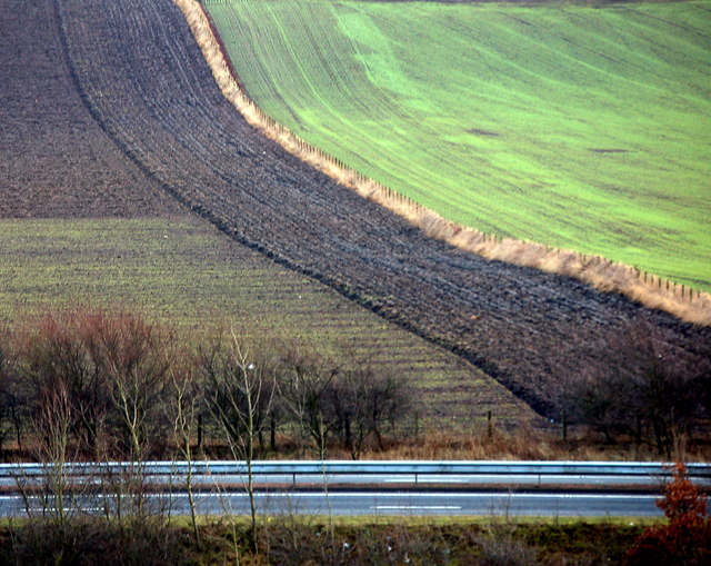
Farmland near Cowdenbeath
Recently cultivated land at Cuttlehill. the A92 dual carriageway runs across the foreground
 Map © Crown Copyright")
TIP: Click the map for more Large scale mapping
- Grid Square
- NT1589, 9 images (more nearby 🔍)
- Photographer
- Paul McIlroy (more nearby)
- Date Taken
- Tuesday, 13 January, 2009 (more nearby)
- Submitted
- Tuesday, 13 January, 2009
- Subject Location
-
OSGB36:
 NT 155 893 [100m precision]
WGS84: 56:5.3886N 3:21.5572W - Camera Location
-
OSGB36: NT 152 899
- View Direction
- South-southeast (about 157 degrees)