2009
TQ2806 : Goldstone Crescent
taken 15 years ago, near to West Blatchington, Brighton And Hove, England
This is 1 of 7 images, with title Goldstone Crescent in this square
Goldstone Crescent
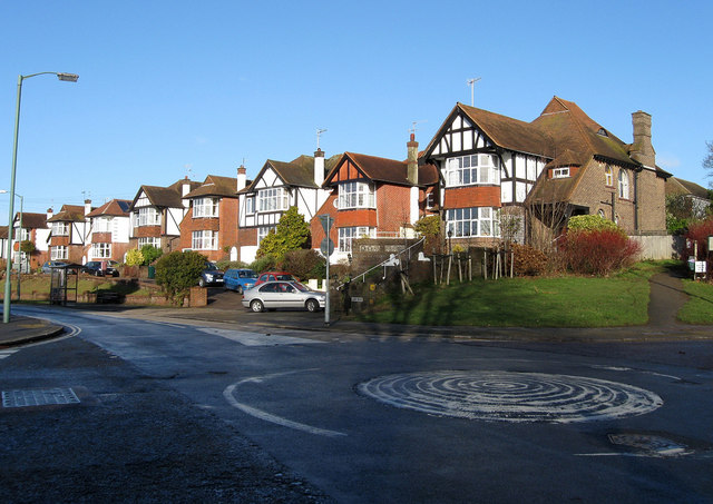
Viewed from the junction with Woodland Drive and having followed the eastern side of what was once Goldstone Bottom it now descends to run along the former valley floor for the rest of its course. The path on the right is the start of a bridleway that goes to Red Hill and Dyke Road. It connects Old Shoreham Road, the A270, with King George VI Avenue, the A2038, and consequently has been known to have been a bit of a rat run though this has lessened since the building of the bypass. As part of the deal in buying the land for Hove Park, the Nevill family had an option to develop what was soon known as Goldstone Crescent being marked as such on 1911 map. However, development was taken up until the 1920s and most of the length of road had been built upon by the end of the 1930s.
 Map © Crown Copyright")
TIP: Click the map for more Large scale mapping
- Grid Square
- TQ2806, 200 images (more nearby 🔍)
- Photographer
- Simon Carey (more nearby)
- Date Taken
- Sunday, 18 January, 2009 (more nearby)
- Submitted
- Monday, 19 January, 2009
- Subject Location
-
OSGB36:
 TQ 285 068 [100m precision]
WGS84: 50:50.8084N 0:10.5141W - Camera Location
-
OSGB36: TQ 285 068
- View Direction
- Northwest (about 315 degrees)