2009
NN3104 : Burn on lower southern slope of Cruach Tairbeirt
taken 15 years ago, near to Tarbet, Argyll And Bute, Scotland
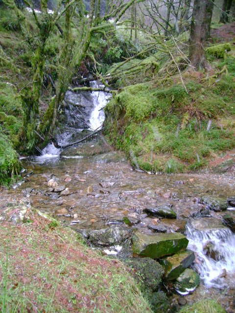
Burn on lower southern slope of Cruach Tairbeirt
A popular recreational footpath fords the burn here as water cascades down the steep southern side of Cruach Tairbeirt on its way to Loch Lomond. Wet snow can be seen falling in the foreground.
 Map © Crown Copyright")
TIP: Click the map for more Large scale mapping
- Grid Square
- NN3104, 108 images (more nearby 🔍)
- Photographer
- Mark Nightingale (more nearby)
- Date Taken
- Wednesday, 21 January, 2009 (more nearby)
- Submitted
- Wednesday, 21 January, 2009
- Subject Location
-
OSGB36:
 NN 310 048 [100m precision]
WGS84: 56:12.3702N 4:43.4917W - Camera Location
-
OSGB36: NN 310 048
- View Direction
- NORTH (about 0 degrees)