2009
NG1843 : North end of An Dubh Loch
taken 15 years ago, 3 km from Ramasaig, Isle of Skye, Scotland
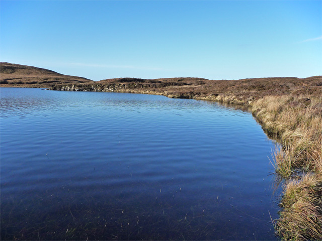
North end of An Dubh Loch
Looking a lot more 'gorm' than 'dubh' on a perfect January morning.
 Map © Crown Copyright")
TIP: Click the map for more Large scale mapping
- Grid Square
- NG1843, 8 images (more nearby 🔍)
- Photographer
- John Allan (more nearby)
- Date Taken
- Monday, 26 January, 2009 (more nearby)
- Submitted
- Monday, 26 January, 2009
- Subject Location
-
OSGB36:
 NG 188 430 [100m precision]
WGS84: 57:23.4465N 6:40.8584W - Camera Location
-
OSGB36: NG 189 430
- View Direction
- WEST (about 270 degrees)