2009
SP5196 : Geology at Croft Quarry
taken 15 years ago, near to Huncote, Leicestershire, England
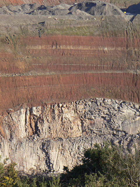
Geology at Croft Quarry
A more detailed view of the area shown in SP5196 : 3 stages of geological development at Croft Quarry.. The magma upwelling can be seen clearly here, just to the left of centre.
N.B. The noticeable horizontal bands about half-way up the granite, and halfway between the granite top and the main light band of sedimentary rock are ledges remaining from Quarrying activity, not geological features.
N.B. The noticeable horizontal bands about half-way up the granite, and halfway between the granite top and the main light band of sedimentary rock are ledges remaining from Quarrying activity, not geological features.
 Map © Crown Copyright")
TIP: Click the map for more Large scale mapping
- Grid Square
- SP5196, 59 images (more nearby 🔍)
- Photographer
- Alan Murray-Rust (more nearby)
- Date Taken
- Friday, 23 January, 2009 (more nearby)
- Submitted
- Monday, 26 January, 2009
- Subject Location
-
OSGB36:
 SP 512 967 [100m precision]
WGS84: 52:33.9701N 1:14.6849W - Camera Location
-
OSGB36: SP 510 966
- View Direction
- East-northeast (about 67 degrees)