2006
SE3027 : South Leeds des res
taken 18 years ago, near to Middleton, Leeds, England
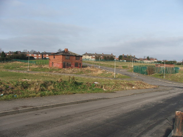
South Leeds des res.
All the other council houses around this one were demolished a few years ago. For some reason this one was left standing. On the Junction of Thorpe Road and Acre Mount.
 Map © Crown Copyright")
TIP: Click the map for more Large scale mapping
- Grid Square
- SE3027, 149 images (more nearby 🔍)
- Photographer
- Steve Partridge (more nearby)
- Date Taken
- Monday, 30 January, 2006 (more nearby)
- Submitted
- Monday, 30 January, 2006
- Subject Location
-
OSGB36:
 SE 305 276 [100m precision]
WGS84: 53:44.6335N 1:32.3417W - Camera Location
-
OSGB36: SE 305 275