2009
SD5049 : The Wyre Way Deteriorates
taken 15 years ago, near to Scorton, Lancashire, England
This is 1 of 2 images, with title starting with The Wyre Way in this square
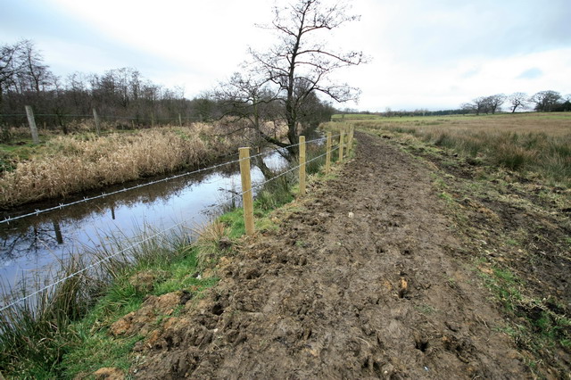
The Wyre Way Deteriorates
A low banking of heavy , wet clay has been used to improve the footpath. A barbed wire fence, wired on the pedestrians' side, dissuades deviance.
 Map © Crown Copyright")
TIP: Click the map for more Large scale mapping
- Grid Square
- SD5049, 35 images (more nearby 🔍)
- Photographer
- Bob Jenkins (more nearby)
- Date Taken
- Sunday, 22 February, 2009 (more nearby)
- Submitted
- Sunday, 22 February, 2009
- Subject Location
-
OSGB36:
 SD 502 499 [100m precision]
WGS84: 53:56.5680N 2:45.6098W - Camera Location
-
OSGB36: SD 502 499
- View Direction
- NORTH (about 0 degrees)