2009
SX6869 : Moorland below Wheal Emma Leat
taken 15 years ago, near to Scorriton, Devon, England
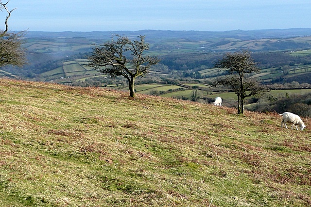
Moorland below Wheal Emma Leat
The lower, east facing slopes of the moor and tamer, and provide rough grazing for sheep. The view is east over Holne.
 Map © Crown Copyright")
TIP: Click the map for more Large scale mapping
- Grid Square
- SX6869, 32 images (more nearby 🔍)
- Photographer
- Graham Horn (more nearby)
- Date Taken
- Monday, 16 February, 2009 (more nearby)
- Submitted
- Monday, 23 February, 2009
- Subject Location
-
OSGB36:
 SX 685 690 [100m precision]
WGS84: 50:30.3701N 3:51.3468W - Camera Location
-
OSGB36: SX 684 690
- View Direction
- East-northeast (about 67 degrees)