2009
TQ6259 : Sign on fence around Hognore Farm
taken 15 years ago, near to Fairseat, Kent, England
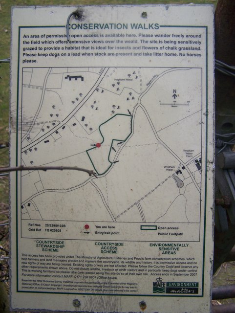
Sign on fence around Hognore Farm
As seen from footpath from A227 Gravesend Road to Pilgrims Way.
Open Access area managed by National Trust - called Wrotham Water.
Open Access area managed by National Trust - called Wrotham Water.
 Map © Crown Copyright")
TIP: Click the map for more Large scale mapping
- Grid Square
- TQ6259, 102 images (more nearby 🔍)
- Photographer
- David Anstiss (more nearby)
- Date Taken
- Tuesday, 17 February, 2009 (more nearby)
- Submitted
- Wednesday, 25 February, 2009
- Subject Location
-
OSGB36:
 TQ 623 599 [100m precision]
WGS84: 51:18.9137N 0:19.7248E - Camera Location
-
OSGB36: TQ 623 599
- View Direction
- EAST (about 90 degrees)