2009
SX6360 : Burford Down
taken 15 years ago, near to Harford, Devon, England
This is 1 of 3 images, with title Burford Down in this square
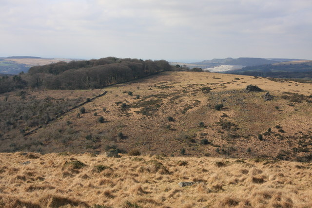
Burford Down
Looking across the Erme valley; capped by the Hall Plantation and with Tristis Rock on the right. Lee Moor china clay works in the distance.
 Map © Crown Copyright")
TIP: Click the map for more Large scale mapping
- Grid Square
- SX6360, 17 images (more nearby 🔍)
- Photographer
- Guy Wareham (more nearby)
- Date Taken
- Saturday, 28 February, 2009 (more nearby)
- Submitted
- Sunday, 1 March, 2009
- Subject Location
-
OSGB36:
 SX 635 601 [100m precision]
WGS84: 50:25.5351N 3:55.3223W - Camera Location
-
OSGB36: SX 644 599
- View Direction
- West-northwest (about 292 degrees)