2009
NY7395 : Nichol's Bog
taken 15 years ago, near to Smallhope Burn [water Feature], Northumberland, Great Britain
This is 1 of 2 images, with title Nichol's Bog in this square
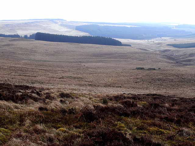
Nichol's Bog
Seen from Lough Knowe below Long Crag, looking down to Nichols' Bog and the valley of the Smallhope Burn. Part of the Emblehope estate, an extremely remote and inaccessible area in northern Northumberland, an enclave of some 3,000 hectares comprising just two houses and an extensive area of very rough wet moorland supporting some 1500 ewes, almost totally surrounded by Kielder Forest. There are a number of small scattered plantations within the area.
 Map © Crown Copyright")
TIP: Click the map for more Large scale mapping
- Grid Square
- NY7395, 2 images (more nearby 🔍)
- Photographer
- Oliver Dixon (more nearby)
- Date Taken
- Saturday, 28 February, 2009 (more nearby)
- Submitted
- Monday, 2 March, 2009
- Subject Location
-
OSGB36:
 NY 735 954 [100m precision]
WGS84: 55:15.1561N 2:25.0770W - Camera Location
-
OSGB36: NY 730 959
- View Direction
- Southeast (about 135 degrees)