2009
SW6841 : Path to Barncoose
taken 15 years ago, near to Redruth, Cornwall, England
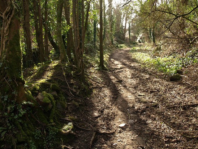
Path to Barncoose
Public footpath 205/2/1 climbs amid trees near the site of Wheal Tehidy, a copper and tin mine.
 Map © Crown Copyright")
TIP: Click the map for more Large scale mapping
- Grid Square
- SW6841, 53 images (more nearby 🔍)
- Photographer
- Derek Harper (more nearby)
- Date Taken
- Monday, 23 February, 2009 (more nearby)
- Submitted
- Monday, 2 March, 2009
- Subject Location
-
OSGB36:
 SW 6819 4193 [10m precision]
WGS84: 50:13.9092N 5:15.1058W - Camera Location
-
OSGB36: SW 6820 4194
- View Direction
- Southwest (about 225 degrees)