2009
SP8807 : The West End of Boddington Banks
taken 15 years ago, near to Wendover, Buckinghamshire, England
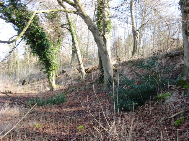
The West End of Boddington Banks
Boddington Hill is a spur that juts out from the main body of the Chiltern Hills. As a result the land falls off steeply on three sides. This makes it an ideal defensible position for a hill fort. This picture shows the defensive bank at the west end of the ancient camp. Originally there was probably a more noticeable ditch at this point.
 Map © Crown Copyright")
TIP: Click the map for more Large scale mapping
- Grid Square
- SP8807, 17 images (more nearby 🔍)
- Photographer
- Chris Reynolds (more nearby)
- Date Taken
- Monday, 2 March, 2009 (more nearby)
- Submitted
- Monday, 2 March, 2009
- Subject Location
-
OSGB36:
 SP 880 079 [100m precision]
WGS84: 51:45.7934N 0:43.4984W - Camera Location
-
OSGB36: SP 880 079
- View Direction
- Northeast (about 45 degrees)