2009
ST6954 : Rymans Engineering Yard, Radstock
taken 15 years ago, near to Radstock, Bath And North East Somerset, England
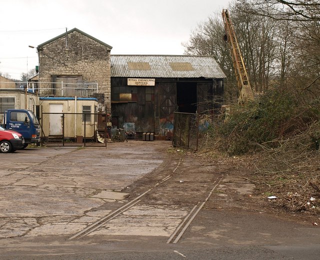
Rymans Engineering Yard, Radstock
A fragment of Radstock's industrial history. In the foreground are the rails mentioned in ST6954 : Buildings by Frome Road, Radstock. Clearly there was a level crossing here across Frome Road. The tracks ran through a cutting which is now a SNCI (Site of Nature Conservation Importance).
 Map © Crown Copyright")
TIP: Click the map for more Large scale mapping
- Grid Square
- ST6954, 26 images (more nearby 🔍)
- Photographer
- Derek Harper (more nearby)
- Date Taken
- Wednesday, 25 February, 2009 (more nearby)
- Submitted
- Monday, 2 March, 2009
- Subject Location
-
OSGB36:
 ST 6911 5476 [10m precision]
WGS84: 51:17.4677N 2:26.6622W - Camera Location
-
OSGB36: ST 6913 5482
- View Direction
- South-southwest (about 202 degrees)