2009
NT4559 : The A68 at Soutra
taken 15 years ago, near to Fala, Midlothian, Scotland
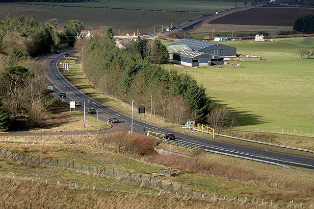
The A68 at Soutra
Viewed from Soutra Hill with Soutra Farm on the right.
 Map © Crown Copyright")
TIP: Click the map for more Large scale mapping
- Grid Square
- NT4559, 28 images (more nearby 🔍)
- Photographer
- Walter Baxter (more nearby)
- Date Taken
- Sunday, 1 March, 2009 (more nearby)
- Submitted
- Monday, 2 March, 2009
- Subject Location
-
OSGB36:
 NT 4550 5933 [10m precision]
WGS84: 55:49.4475N 2:52.2875W - Camera Location
-
OSGB36: NT 4577 5918
- View Direction
- West-northwest (about 292 degrees)