2009
NY7499 : Kielder Forest Drive
taken 15 years ago, 4 km SSW of Byrness, Northumberland, England
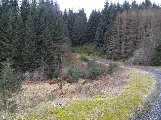
Kielder Forest Drive
The Forest Drive is a private toll road from Byrness in Redesdale to Kielder village. It is closed to private motorists in winter. Here the Drive crosses Cairn Cleugh, a tributary of the Blakehope Burn. As on my previous visit, I was unable to identify the "Hermit's Well" which is shown on the map down the slope to the left.
 Map © Crown Copyright")
TIP: Click the map for more Large scale mapping
- Grid Square
- NY7499, 5 images (more nearby 🔍)
- Photographer
- Oliver Dixon (more nearby)
- Date Taken
- Saturday, 28 February, 2009 (more nearby)
- Submitted
- Tuesday, 3 March, 2009
- Subject Location
-
OSGB36:
 NY 745 998 [100m precision]
WGS84: 55:17.4992N 2:24.1285W - Camera Location
-
OSGB36: NY 746 998
- View Direction
- West-southwest (about 247 degrees)