2009
SH6355 : Bwlch y Moch, Crib Goch, and Snowdon/Yr Wyddfa
taken 15 years ago, 5 km N of Plas Gwynant, Gwynedd, Wales
This is 1 of 5 images, with title starting with Bwlch y in this square
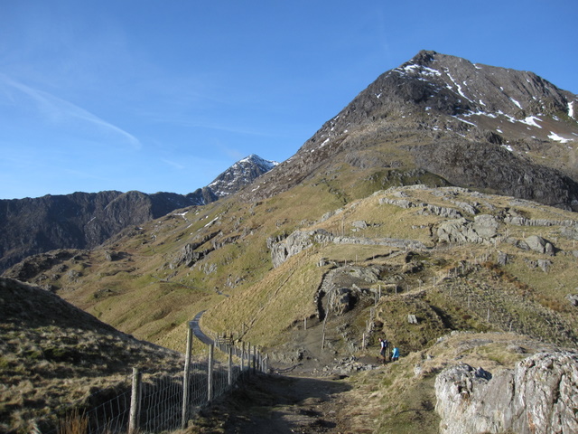
Bwlch y Moch, Crib Goch, and Snowdon/Yr Wyddfa
Looking down on Bwlch y Moch from the path to The Horns. The prominent peak in the foreground is Crib Goch, and in the distance the snow-capped summit of Snowdon can be seen.
 Map © Crown Copyright")
TIP: Click the map for more Large scale mapping
- Grid Square
- SH6355, 88 images (more nearby 🔍)
- Photographer
- John S Turner (more nearby)
- Date Taken
- Friday, 20 February, 2009 (more nearby)
- Submitted
- Tuesday, 3 March, 2009
- Subject Location
-
OSGB36:
 SH 6333 5525 [10m precision]
WGS84: 53:4.6163N 4:2.4982W - Camera Location
-
OSGB36: SH 6336 5525
- View Direction
- WEST (about 270 degrees)