2008
SX8972 : Netherton Point, Teign estuary
taken 15 years ago, near to Netherton, Devon, England
This is 1 of 5 images, with title Netherton Point, Teign estuary in this square
Netherton Point, Teign estuary
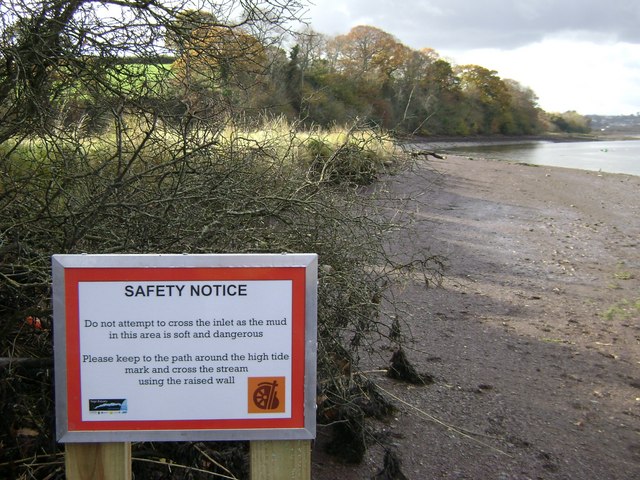
The audience for this sign is the westbound walker on the Templer Way, whose logo appears lower right. The inlet is just beyond the sunlit vegetation of the mini-saltmarsh.
 Map © Crown Copyright")
TIP: Click the map for more Large scale mapping
- Grid Square
- SX8972, 179 images (more nearby 🔍)
- Photographer
- Robin Stott (more nearby)
- Date Taken
- Wednesday, 12 November, 2008 (more nearby)
- Submitted
- Tuesday, 3 March, 2009
- Subject Location
-
OSGB36:
 SX 891 722 [100m precision]
WGS84: 50:32.3531N 3:33.9137W - Camera Location
-
OSGB36: SX 891 722
- View Direction
- WEST (about 270 degrees)