2009
SU6066 : Weir at Padworth Mill
taken 15 years ago, near to Aldermaston Wharf, West Berkshire, England
This is 1 of 2 images, with title Weir at Padworth Mill in this square
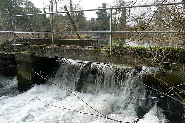
Weir at Padworth Mill
This is one of the streams of the River Kennet. There is a trout farm here, and a fish ladder for them to reach this point.
 Map © Crown Copyright")
TIP: Click the map for more Large scale mapping
- Grid Square
- SU6066, 58 images (more nearby 🔍)
- Photographer
- Graham Horn (more nearby)
- Date Taken
- Sunday, 1 March, 2009 (more nearby)
- Submitted
- Wednesday, 4 March, 2009
- Subject Location
-
OSGB36:
 SU 605 665 [100m precision]
WGS84: 51:23.6804N 1:7.8569W - Camera Location
-
OSGB36: SU 605 665
- View Direction
- Southwest (about 225 degrees)