2006
SE0997 : Low Wood Rapid on the Swale
taken 18 years ago, near to Stainton, North Yorkshire, England
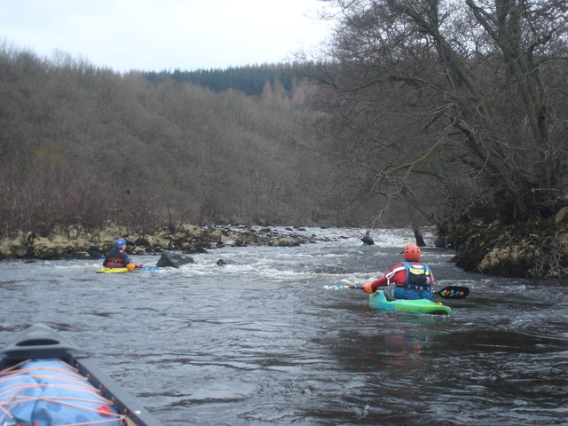
Low Wood Rapid on the Swale
This rapid starts with a wide shallow area (there are stepping stones visible on aerial photos although these are not seen by canoeists if the river is at an adequate level). Paddlers then try to get river left to the deeper channel, whilst avoiding overhanging trees on the left bank, and the central rock at the bottom. The photo shows a depressingly low level (the River Swale rises and falls quickly and is hard to catch at a good level). With a bit more water, a playwave forms at the bottom of the rapid, but then at high levels washes out completely.
 Map © Crown Copyright")
TIP: Click the map for more Large scale mapping
- Grid Square
- SE0997, 21 images (more nearby 🔍)
- Photographer
- Andy Waddington (more nearby)
- Date Taken
- Sunday, 19 March, 2006 (more nearby)
- Submitted
- Monday, 9 March, 2009
- Subject Location
-
OSGB36:
 SE 0916 9773 [10m precision]
WGS84: 54:22.4996N 1:51.6299W - Camera Location
-
OSGB36: SE 0915 9775
- View Direction
- SOUTH (about 180 degrees)