1989
SH6913 : Hillside north of Cadair Idris
taken 35 years ago, 4 km SSE of Abergwynant, Gwynedd, Wales
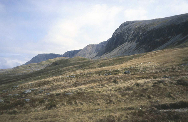
Hillside north of Cadair Idris
From the Pony Path looking south-east to the Cadair Idris ridge. Rough ground here which is used for sheep grazing.
 Map © Crown Copyright")
TIP: Click the map for more Large scale mapping
- Grid Square
- SH6913, 57 images (more nearby 🔍)
- Photographer
- Trevor Rickard (more nearby)
- Date Taken
- April 1989 (more nearby)
- Submitted
- Tuesday, 10 March, 2009
- Subject Location
-
OSGB36:
 SH 697 138 [100m precision]
WGS84: 52:42.3899N 3:55.7913W - Camera Location
-
OSGB36: SH 693 139
- View Direction
- East-southeast (about 112 degrees)