2009
TQ3496 : Southbury Station, Enfield
taken 15 years ago, near to Enfield, England
This is 1 of 3 images, with title Southbury Station, Enfield in this square
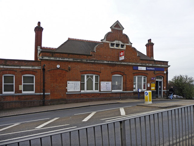
Southbury Station, Enfield
The railway line from Bury Street Junction, north of the current Edmonton Green station, to Cheshunt was opened by the Great Eastern Railway on October 1, 1891. It was known as the Churchbury Loop.
The district served by the line was still predominantly rural, and the coming of the tram to Waltham Cross in 1904 saw the railway unable to compete. Passenger services ceased on October 1, 1909, but were reinstated for the benefit of munitions workers between March 1, 1915 and July 1, 1919.
After that the line was only served by freight trains until the line was electrified as part of a wider scheme, and Southbury station reopened to passengers on November 21, 1962. The line is now known as the Southbury Loop.
The station was opened as Churchbury railway station, and did not gain its current name until 1962. The goods depot at the station closed in 1970.
Link
 Map © Crown Copyright")
TIP: Click the map for more Large scale mapping
- Grid Square
- TQ3496, 134 images (more nearby 🔍)
- Photographer
- Christine Matthews (more nearby)
- Date Taken
- Wednesday, 11 March, 2009 (more nearby)
- Submitted
- Friday, 13 March, 2009
- Subject Location
-
OSGB36:
 TQ 348 961 [100m precision]
WGS84: 51:38.8954N 0:3.1560W - Camera Location
-
OSGB36: TQ 348 962
- View Direction
- SOUTH (about 180 degrees)