2009
SE1221 : Lower Edge Road, Rastrick
taken 15 years ago, near to Rastrick, Calderdale, England
This is 1 of 3 images, with title Lower Edge Road, Rastrick in this square
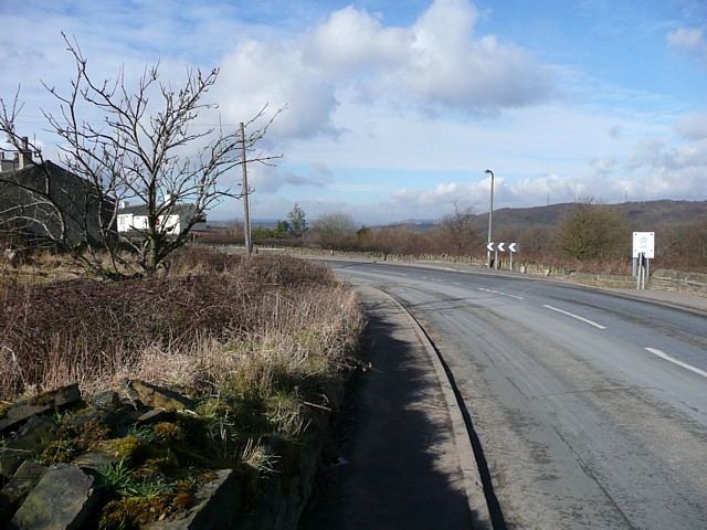
Lower Edge Road, Rastrick
The rough ground on the left was occupied by a building on six-inch maps of 1850 and c.1930. It might have been a farm or possibly the Mason's Arms public house. The white building is the Royal Oak.
 Map © Crown Copyright")
TIP: Click the map for more Large scale mapping
- Grid Square
- SE1221, 155 images (more nearby 🔍)
- Photographer
- Humphrey Bolton (more nearby)
- Date Taken
- Friday, 6 March, 2009 (more nearby)
- Submitted
- Friday, 13 March, 2009
- Subject Location
-
OSGB36:
 SE 128 214 [100m precision]
WGS84: 53:41.3338N 1:48.4592W - Camera Location
-
OSGB36: SE 128 214
- View Direction
- WEST (about 270 degrees)