2009
SO5270 : Dumblehole Brook
taken 15 years ago, near to Ashford Carbonell, Shropshire, England
This is 1 of 9 images, with title Dumblehole Brook in this square
Dumblehole Brook
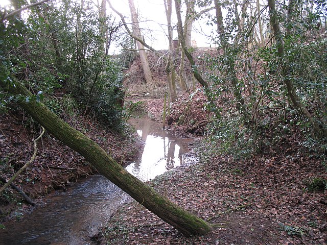
The brook is running deep beneath the surrounding land. It has cut down to the new level of the river, which has been much larger since the Teme was diverted this way in glacial times. The dingle was formed by a retreating waterfall - the falls are behind The Dumblehole ("Dumbleholes Farm" according to the Ordnance Survey) at SO52697020.
The photograph was taken from the remains of a footbridge which carried a footpath around a ford at Dumblehole. The ford was filled in 1973, one plank of the now obsolete bridge remains.
The photograph was taken from the remains of a footbridge which carried a footpath around a ford at Dumblehole. The ford was filled in 1973, one plank of the now obsolete bridge remains.
 Map © Crown Copyright")
TIP: Click the map for more Large scale mapping
- Grid Square
- SO5270, 329 images (more nearby 🔍)
- Photographer
- Richard Webb (more nearby)
- Date Taken
- Sunday, 15 February, 2009 (more nearby)
- Submitted
- Saturday, 14 March, 2009
- Subject Location
-
OSGB36:
 SO 525 701 [100m precision]
WGS84: 52:19.6321N 2:41.8518W - Camera Location
-
OSGB36: SO 525 701
- View Direction
- West-southwest (about 247 degrees)