2009
TG1820 : Path past clearing
taken 15 years ago, near to Hevingham, Norfolk, England
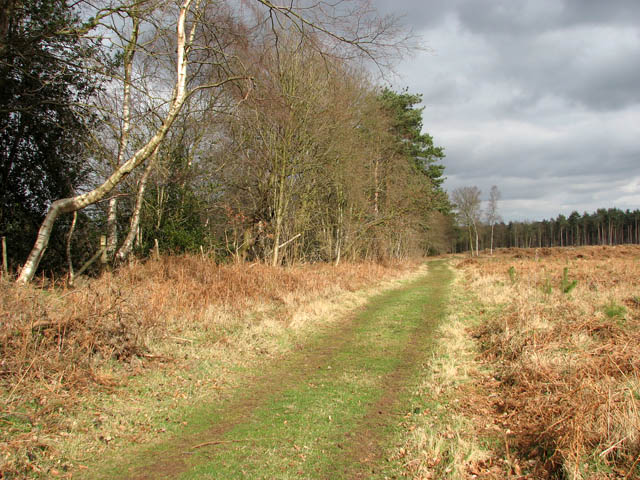
Path past clearing
This footpath skirts the northwestern edge of Hevingham Park, leading past a large clearing where young pine trees have been planted. Hevingham Park is a 225 acres mixed plantation located just south of the village of Hevingham. It consists of Scots and Corsican pine, oak, larch, poplar, alder and sycamore trees which were planted over a 20-year period, beginning in the late 1940s. There are no waymarkers but paths are well defined and the rides are arranged in a grid-like pattern. This woodland can become very wet after heavy rainfalls.
 Map © Crown Copyright")
TIP: Click the map for more Large scale mapping
- Grid Square
- TG1820, 50 images (more nearby 🔍)
- Photographer
- Evelyn Simak (more nearby)
- Date Taken
- Saturday, 14 March, 2009 (more nearby)
- Submitted
- Saturday, 14 March, 2009
- Subject Location
-
OSGB36:
 TG 189 202 [100m precision]
WGS84: 52:44.1382N 1:14.4569E - Camera Location
-
OSGB36: TG 188 202
- View Direction
- Northeast (about 45 degrees)