2009
SP3065 : Jephson's Farm, Warwick
taken 15 years ago, near to Warwick, Warwickshire, England
Jephson's Farm, Warwick
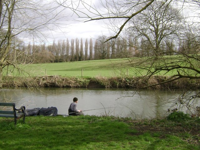
North of the canal, out of shot, right, is grazing land that slopes down to the River Avon and its tributary the Leam. See Link , right.
Beyond, Lombardy poplars follow the bank of the Leam at Edmondscote athletics track.
There are many fishing pegs along this stretch of the Avon, which can be enjoyed from public open space and a public path.
Beyond, Lombardy poplars follow the bank of the Leam at Edmondscote athletics track.
There are many fishing pegs along this stretch of the Avon, which can be enjoyed from public open space and a public path.
 Map © Crown Copyright")
TIP: Click the map for more Large scale mapping
- Grid Square
- SP3065, 648 images (more nearby 🔍)
- Photographer
- Robin Stott (more nearby)
- Date Taken
- Saturday, 14 March, 2009 (more nearby)
- Submitted
- Sunday, 15 March, 2009
- Subject Location
-
OSGB36:
 SP 301 654 [100m precision]
WGS84: 52:17.1552N 1:33.6098W - Camera Location
-
OSGB36: SP 300 654
- View Direction
- EAST (about 90 degrees)